|
search place name
|
||
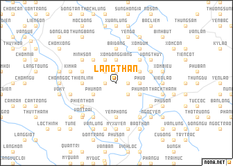
Làng Thân (Thanh Hóa, Vietnam)Làng Thân is a town in the Thanh Hóa region of Vietnam. An overview map of the region around Làng Thân is displayed below.
regional and 3d topo map of Làng Thân, Vietnam ::
Làng Thân airports ::
The nearest airport is HAN - Hanoi Noibai Intl, located 120.5 km north of Làng Thân.
Nearby towns ::
Ðông Lộc (1.7km west) //
Bằng Phú (1.9km north) //
Xóm Ðồng Chu (1.7km east) //
Chòm Rồng (2.5km north west) //
Cự Lý (2.5km south east) //
Xóm Ðồng Giang (3.7km north) //
Phú Ổ (3.5km east) //
Chòm Mồn (3.9km south west) //
Phú Môn (3.9km south west) //
Chòm Thanh (3.9km south west) //
La Sơn (4.1km north west) //
Phú Môn (3.9km south east) //
An Ðo18 (3.9km north east) //
Chòm Móng (5.1km north west) //
An Da (5.1km north east) //
Tàn Lâp (5.6km south) //
Thiên Linh (5.2km west) //
Chòm Ro (5.2km west) //
Yên Phong (5.6km south) //
Bái Ðăng (5.6km north) //
Chòm Báy (5.5km west) //
An Do18 (5.5km east) //
Chòm Lai (6.6km south west) //
Cẩm Hoàng (6.6km south west) //
Phiến Thôn (6.4km south west) //
Minh Son (6.4km north west) //
Cổ Tế (6.6km south east) //
Xóm Ðụm (6.6km north east) //
Ðai Ðinh (6.4km south east) //
[all distances 'as the bird flies' and approximate] 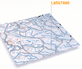 Places with similar names to Làng Thân, Vietnam ::
// Llangathen (GB)
// Làng Than (VN)
// Làng Thôn (VN)
// Làng Thon (VN)
// Làng Than (VN)
// Làng Thanh (VN)
// Làng Thành (VN)
// Làng Thiên (VN)
// Long Thành (VN)
// Long Thạnh (VN)
Disclaimer :: Information on this page comes without warranty of any kind |
||
|
Where is Làng Thân? Elevation and coordinates ::
Latitude (lat): 20°9'0"N Longitude (lon): 105°36'0"E
Elevation (approx.): 79m (map arrows pan, magnifying glasses zoom) |
||
|
Visiting Làng Thân? Hotel/Accommodation ::
Book a hotel in Làng Thân Travel Guide ::
Buy a travel guide for Vietnam rental cars ::
car rental offers GPS waypoint ::
download a GPX waypoint (PoI) of Làng Thân for your GPS receiver
|
||