|
search place name
|
||
Làng Thon (Thanh Hóa, Vietnam)Làng Thon is a town in the Thanh Hóa region of Vietnam. An overview map of the region around Làng Thon is displayed below.
regional and 3d topo map of Làng Thon, Vietnam ::

Làng Thon airports ::
The nearest airport is HAN - Hanoi Noibai Intl, located 137.5 km north of Làng Thon.
Nearby towns ::
Tam Dồng (0.0km north) //
Mỹ Lộc (0.0km north) //
Mai Vuc (1.9km north) //
Yên Hoành (2.5km north west) //
Bồng Trung (2.5km north east) //
Làng Hoàn (3.5km east) //
Mai Trung (3.7km south) //
Thung Thôn (4.1km south west) //
Càng Thượng (4.1km south west) //
Yên Lộc (4.1km north west) //
Ða Bút (4.1km north east) //
Sáo Sơn (4.1km north west) //
Bản Thủy (5.1km north east) //
Trinh Diện (5.1km north west) //
Trí Thủy (5.5km east) //
Trại Mực (5.8km north) //
Bái Ân (5.8km south) //
Hải Quật (6.6km south east) //
Hùng Thôn (6.6km south east) //
Phong Phú (1) (7.4km south) //
Ngưỡng Ðưc (7.6km south) //
Thanh Phú (7.2km west) //
Ngọc Son (7.2km east) //
Du Ngh (7.6km north) //
Pha Ngữ (7.6km north west) //
Ðại Diền (7.6km south east) //
Ða Phúc (7.9km south east) //
Phong Mục (7.9km south east) //
Trà La (7.9km south east) //
[all distances 'as the bird flies' and approximate] 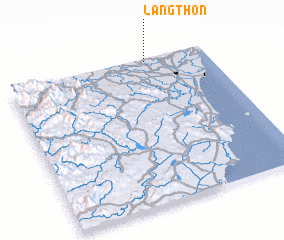 Places with similar names to Làng Thon, Vietnam ::
// Llangathen (GB)
// Làng Than (VN)
// Làng Thôn (VN)
// Làng Than (VN)
// Làng Thân (VN)
// Làng Thanh (VN)
// Làng Thành (VN)
// Làng Thiên (VN)
// Long Thành (VN)
// Long Thạnh (VN)
Disclaimer :: Information on this page comes without warranty of any kind |
||
|
Where is Làng Thon? Elevation and coordinates ::
Latitude (lat): 19°59'0"N Longitude (lon): 105°42'0"E
Elevation (approx.): 9m (map arrows pan, magnifying glasses zoom) |
||
|
Visiting Làng Thon? Hotel/Accommodation ::
Book a hotel in Làng Thon Travel Guide ::
Buy a travel guide for Vietnam rental cars ::
car rental offers GPS waypoint ::
download a GPX waypoint (PoI) of Làng Thon for your GPS receiver
|
||