|
search place name
|
||
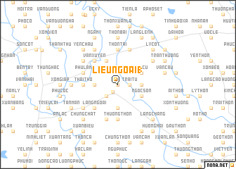
Liễu Ngoai (1) (Hà Bắc, Vietnam)Liễu Ngoai (1) is a town in the Hà Bắc region of Vietnam. An overview map of the region around Liễu Ngoai (1) is displayed below.
regional and 3d topo map of Liễu Ngoai (1), Vietnam ::
Liễu Ngoai (1) airports ::
The nearest airport is HAN - Hanoi Noibai Intl, located 24.4 km south west of Liễu Ngoai (1).
Nearby towns ::
Hiệp Hòa (0.0km north) //
Ðức Thắng (1.4km south west) //
Trại Tụ (1.7km east) //
Hùng Thắng (2.5km south west) //
Ðống Tâu (3.5km west) //
Làng Chùa (3.7km south) //
Danh Thắng (3.7km south) //
Ngọc Cụ (3.5km east) //
An Cập (4.1km north west) //
Thanh Vân (4.1km north west) //
Tri Cu (3.9km north east) //
Ngọc Sơn (3.9km south east) //
Vân Xuyên (5.1km north west) //
Làng Ngoai (5.1km south west) //
Thái Thọ (5.2km west) //
Phúc Thắng (5.6km south) //
Thượng Thôn (5.6km south) //
Thôn Tai (5.6km north) //
Phù Lâm (5.5km west) //
Ðồng Tốt (5.8km south) //
Phao Thanh (5.8km north) //
Làng Miện (6.4km north east) //
Cổ Pháp (6.4km north west) //
Hà Châu (6.5km north west) //
Mai Sơn (6.4km south west) //
Thôn Bãi (7.4km north) //
Thù Cốc (6.9km west) //
Vân Cầu (7.1km east) //
Yên Châu (7.6km north west) //
[all distances 'as the bird flies' and approximate] 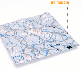 Places with similar names to Liễu Ngoai (1), Vietnam ::
Disclaimer :: Information on this page comes without warranty of any kind |
||
|
Where is Liễu Ngoai (1)? Elevation and coordinates ::
Latitude (lat): 21°22'0"N Longitude (lon): 105°59'0"E
Elevation (approx.): 28m (map arrows pan, magnifying glasses zoom) |
||
|
Visiting Liễu Ngoai (1)? Hotel/Accommodation ::
Book a hotel in Liễu Ngoai (1) Travel Guide ::
Buy a travel guide for Vietnam rental cars ::
car rental offers GPS waypoint ::
download a GPX waypoint (PoI) of Liễu Ngoai (1) for your GPS receiver
|
||