|
search place name
|
||
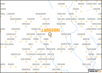
Lủng Goái (Cao Bằng, Vietnam)Lủng Goái is a town in the Cao Bằng region of Vietnam. An overview map of the region around Lủng Goái is displayed below.
regional and 3d topo map of Lủng Goái, Vietnam ::
Lủng Goái airports ::
The nearest airport is HAN - Hanoi Noibai Intl, located 183.1 km south of Lủng Goái.
Nearby towns ::
Làng Thốc (0.0km north) //
Phan Noc (1.9km south) //
Làng Roc (2.5km north west) //
Nà Bó (2.5km south west) //
Làng Kiển (3.4km west) //
Làng Ngằm (3.9km north west) //
Sam Kha (4.1km north west) //
Ché Cà (3.9km south west) //
Nà Pài (4.1km south west) //
Bản Cáu (3.9km north east) //
Bản Lạp (3.9km north east) //
Phia Deng (5.0km north west) //
Sốc Giang (5.0km north east) //
Canh Tao (5.0km south east) //
Pàc Puồng (5.1km east) //
Mu Cải (5.1km west) //
Bản Giàng (5.6km south) //
Lộng Ái (5.4km west) //
Thong Tau (5.4km west) //
Ðỏng Go (5.4km west) //
Cốc Lại (5.8km north) //
Ta Bốc (5.4km west) //
Làng Ri (1) (6.5km south west) //
Quảng Trù (6.3km south east) //
Ðán Deng (6.5km south east) //
Cốc Xâu (6.5km north east) //
Pả Chang (6.8km west) //
Pác Cai (7.4km south) //
Lủng Hình (7.6km south) //
[all distances 'as the bird flies' and approximate] 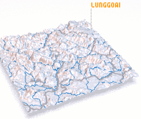 Places with similar names to Lủng Goái, Vietnam ::
Disclaimer :: Information on this page comes without warranty of any kind |
||
|
Where is Lủng Goái? Elevation and coordinates ::
Latitude (lat): 22°52'0"N Longitude (lon): 105°59'0"E
Elevation (approx.): 1103m (map arrows pan, magnifying glasses zoom) |
||
|
Visiting Lủng Goái? Hotel/Accommodation ::
Book a hotel in Lủng Goái Travel Guide ::
Buy a travel guide for Vietnam rental cars ::
car rental offers GPS waypoint ::
download a GPX waypoint (PoI) of Lủng Goái for your GPS receiver
|
||