|
search place name
|
||
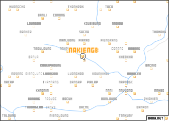
Na Kiéng (1) (Cao Bằng, Vietnam)Na Kiéng (1) is a town in the Cao Bằng region of Vietnam. An overview map of the region around Na Kiéng (1) is displayed below.
regional and 3d topo map of Na Kiéng (1), Vietnam ::
Na Kiéng (1) airports ::
The nearest airport is HAN - Hanoi Noibai Intl, located 184.2 km south of Na Kiéng (1).
Nearby towns ::
Na Bản (0.0km north) //
Pia Rao (3.7km north) //
Luong Hao (4.1km south west) //
Nam Piéng (3.9km north west) //
Kouei Khau (5.0km south east) //
Nam Luong (5.0km north west) //
Sac Na (5.6km north) //
Kouei Loung (5.8km south) //
Pia Làp (5.8km south) //
Bản Sap (5.8km south) //
Piéng Rang (6.3km north east) //
Co Rang (7.1km east) //
Kouei Phoung (7.1km west) //
Kouei Bung (7.6km north) //
Luong Oai (7.8km south west) //
Na Ri (9.0km south east) //
Tham Nang (8.8km south west) //
Cao Tchou (10.1km south west) //
Na Qiou (10.1km north east) //
Nam Cao (10.1km north east) //
[all distances 'as the bird flies' and approximate] 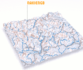 Places with similar names to Na Kiéng (1), Vietnam ::
Disclaimer :: Information on this page comes without warranty of any kind |
||
|
Where is Na Kiéng (1)? Elevation and coordinates ::
Latitude (lat): 22°50'0"N Longitude (lon): 105°22'0"E
Elevation (approx.): 459m (map arrows pan, magnifying glasses zoom) |
||
|
Visiting Na Kiéng (1)? Hotel/Accommodation ::
Book a hotel in Na Kiéng (1) Travel Guide ::
Buy a travel guide for Vietnam rental cars ::
car rental offers GPS waypoint ::
download a GPX waypoint (PoI) of Na Kiéng (1) for your GPS receiver
|
||