|
search place name
|
||
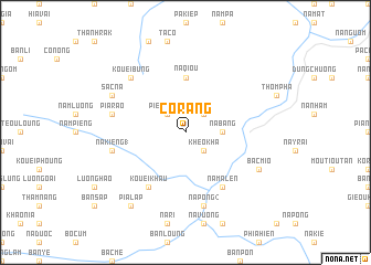
Co Rang (Cao Bằng, Vietnam)Co Rang is a town in the Cao Bằng region of Vietnam. An overview map of the region around Co Rang is displayed below.
regional and 3d topo map of Co Rang, Vietnam ::
Co Rang airports ::
The nearest airport is HAN - Hanoi Noibai Intl, located 184.4 km south of Co Rang.
Nearby towns ::
Piéng Rang (2.5km north west) //
Phieng Phat (2.5km north east) //
Kheo Kha (2.5km south east) //
Na Bang (3.4km east) //
Nam Cao (5.6km north) //
Na Qiou (5.6km north) //
Kouei Khau (6.5km south west) //
Na Ma Len (6.5km south east) //
Pia Rao (7.1km west) //
Na Kiéng (1) (7.1km west) //
Na Bản (7.1km west) //
Na Pong (2) (7.6km south) //
Làng Ca Phu (7.6km south) //
Kouei Bung (7.6km north west) //
Sac Na (7.8km north west) //
Bac Mio (7.8km south east) //
Pia Làp (9.0km south west) //
Kouei Loung (9.0km south west) //
[all distances 'as the bird flies' and approximate] 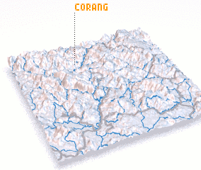 Places with similar names to Co Rang, Vietnam ::
Disclaimer :: Information on this page comes without warranty of any kind |
||
|
Where is Co Rang? Elevation and coordinates ::
Latitude (lat): 22°51'0"N Longitude (lon): 105°26'0"E
Elevation (approx.): 934m (map arrows pan, magnifying glasses zoom) |
||
|
Visiting Co Rang? Hotel/Accommodation ::
Book a hotel in Co Rang Travel Guide ::
Buy a travel guide for Vietnam rental cars ::
car rental offers GPS waypoint ::
download a GPX waypoint (PoI) of Co Rang for your GPS receiver
|
||