|
search place name
|
||
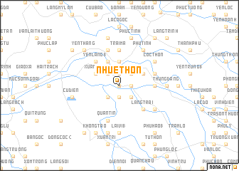
Nhuế Thôn (Thanh Hóa, Vietnam)Nhuế Thôn is a town in the Thanh Hóa region of Vietnam. An overview map of the region around Nhuế Thôn is displayed below.
regional and 3d topo map of Nhuế Thôn, Vietnam ::
Nhuế Thôn airports ::
The nearest airport is HAN - Hanoi Noibai Intl, located 147.2 km north of Nhuế Thôn.
Nearby towns ::
Cao Phong (0.0km north) //
Nam Thuong (0.0km north) //
Boi Trach (0.0km north) //
Thương Gia (1.9km north) //
Quả Nhuệ Thượng (1.9km south) //
Ðại Phú (1.7km east) //
Thọ Xuân (2.5km north west) //
Mỹ Hát (2.5km south west) //
Bich Phương (2.5km south west) //
Liên Phô (2.5km north east) //
Quả Nhuệ Hạ (2.5km south east) //
Ðông Nãi (2.5km south east) //
Canh Hoach (3.7km north) //
Phúc Thuong (4.1km north west) //
Xuân Phố (3.9km north west) //
Dai Ly (2) (3.9km north east) //
Mỹ Hòa (5.1km north west) //
Lãng Ðộng (5.1km north west) //
Yên Lãng (1) (5.1km north west) //
Làng Trại (5.1km south east) //
Phú Thọ (1) (5.6km north) //
Trại Ma (5.6km north) //
Tam Lư (5.2km east) //
Bất Cang (5.2km east) //
Trung Lập (5.8km north) //
Quần Tín (5.8km south) //
Long Linh (5.5km east) //
Cốc Thôn (6.4km north east) //
Phú Tinh (6.6km north east) //
[all distances 'as the bird flies' and approximate] 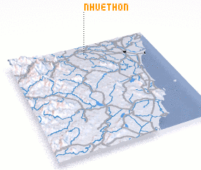 Places with similar names to Nhuế Thôn, Vietnam ::
// Nhuệ Thon (VN)
Disclaimer :: Information on this page comes without warranty of any kind |
||
|
Where is Nhuế Thôn? Elevation and coordinates ::
Latitude (lat): 19°55'0"N Longitude (lon): 105°32'0"E
Elevation (approx.): 12m (map arrows pan, magnifying glasses zoom) |
||
|
Visiting Nhuế Thôn? Hotel/Accommodation ::
Book a hotel in Nhuế Thôn Travel Guide ::
Buy a travel guide for Vietnam rental cars ::
car rental offers GPS waypoint ::
download a GPX waypoint (PoI) of Nhuế Thôn for your GPS receiver
|
||