|
search place name
|
||
Nhuệ Thon (Thanh Hóa, Vietnam)Nhuệ Thon is a town in the Thanh Hóa region of Vietnam. An overview map of the region around Nhuệ Thon is displayed below.
regional and 3d topo map of Nhuệ Thon, Vietnam ::

Nhuệ Thon airports ::
The nearest airport is HAN - Hanoi Noibai Intl, located 157.4 km north of Nhuệ Thon.
Nearby towns ::
Thanh Hóa (0.0km north) //
Tinh Xa (1.7km east) //
Ðống Thôn (1.7km west) //
Kiều Ðại (1.9km south) //
Vệ Yên (2.5km south west) //
Bao Ngoai (3.5km east) //
Thủ Phác (3.5km east) //
Trường Tại (3.7km south) //
Ngọc Am (3.7km south) //
Phúc Sơn (4.1km north east) //
Ðông Tac (4.1km north east) //
Phù Quang (4.1km north east) //
Phúc Sơn (3.9km north east) //
Bao Noi (3.9km north east) //
Bản Nguyen (4.1km north west) //
Văn Thu (4.1km south west) //
Vi Giang (3.9km south west) //
Tức Tranh (5.1km south east) //
Tân Lương (5.1km north west) //
Miếu Thôn (5.1km south west) //
Sơn Vạn (5.2km east) //
Ðộng Sơn (5.6km north) //
Tiền Ðoài (5.6km south) //
Ðại Khối (5.6km north) //
Quảng Ðộ (5.6km south) //
Co Hau (5.8km south) //
Y Xá(1) (5.6km west) //
Trường Tuế (5.6km west) //
Văn Vật (5.8km south) //
[all distances 'as the bird flies' and approximate] 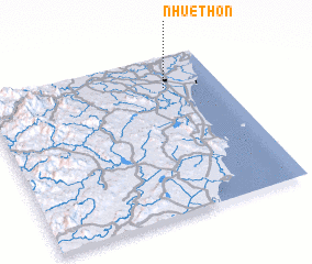 Places with similar names to Nhuệ Thon, Vietnam ::
// Nhuế Thôn (VN)
Disclaimer :: Information on this page comes without warranty of any kind |
||
|
Where is Nhuệ Thon? Elevation and coordinates ::
Latitude (lat): 19°48'0"N Longitude (lon): 105°46'0"E
Elevation (approx.): 7m (map arrows pan, magnifying glasses zoom) |
||
|
Visiting Nhuệ Thon? Hotel/Accommodation ::
Book a hotel in Nhuệ Thon Travel Guide ::
Buy a travel guide for Vietnam rental cars ::
car rental offers GPS waypoint ::
download a GPX waypoint (PoI) of Nhuệ Thon for your GPS receiver
|
||