|
search place name
|
||
Talung Than (Lai Châu, Vietnam)Talung Than is a town in the Lai Châu region of Vietnam. An overview map of the region around Talung Than is displayed below.
regional and 3d topo map of Talung Than, Vietnam ::
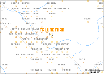
Nearby towns ::
Seo Lung Than (0.0km north) //
San Tia (1.9km south) //
Ta Leng (1.9km south) //
Pin Ngan Tiay (1.7km west) //
Ma Pô Chai (2.5km south east) //
Sin Cao (2.5km north west) //
Kin Tiou (4.1km south west) //
Can Hô (4.1km south west) //
Tam Duong (4.1km south west) //
Can Hô (3.9km south west) //
Seo Lung Than (3.9km south west) //
Lan Than (3.9km south west) //
Pan Kéo (3.9km north west) //
Yang Ma Sin Tiay (5.0km south east) //
Tong Qua Lin (5.0km north west) //
Nhi Duong (5.1km west) //
Sa Yin Cao (5.1km west) //
Lo Suối Tong (5.6km south) //
Nam San (5.5km west) //
Pin Hô (5.8km south) //
Sin Cao (5.5km west) //
Thèn Sin (5.5km west) //
Sin Cao (1) (6.5km south east) //
Su Tâng Hô (6.5km south east) //
Yang Ma Sin Cao (6.5km south east) //
Sin Soui Hô (6.5km north west) //
Seo Lan Than (6.5km south west) //
Pan Linh (6.5km south west) //
Heo Sou San (7.4km south) //
[all distances 'as the bird flies' and approximate] 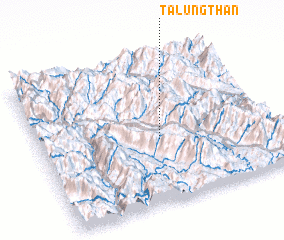 Places with similar names to Talung Than, Vietnam :: Disclaimer :: Information on this page comes without warranty of any kind |
||
|
Where is Talung Than? Elevation and coordinates ::
Latitude (lat): 22°26'0"N Longitude (lon): 103°31'0"E
Elevation (approx.): 1255m (map arrows pan, magnifying glasses zoom) |
||
|
Visiting Talung Than? Hotel/Accommodation ::
Book a hotel in Talung Than Travel Guide ::
Buy a travel guide for Vietnam rental cars ::
car rental offers GPS waypoint ::
download a GPX waypoint (PoI) of Talung Than for your GPS receiver
|
||