|
search place name
|
||
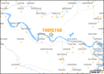
Thong Tho (Vietnam)Thong Tho is a town in Vietnam. An overview map of the region around Thong Tho is displayed below.
regional and 3d topo map of Thong Tho, Vietnam ::
Thong Tho airports ::
The nearest airport is SNO - Sakon Nakhon, located 222.0 km south west of Thong Tho.
Nearby towns ::
Chính Vĩnh (0.0km north) //
Tri Lễ (0.0km north) //
Ðai Ðiền (1.8km west) //
Ða Văn (1.9km south) //
Chợ Xớ (1.9km south) //
Hội Quân (1.9km south) //
Xóm Ðông (3.5km west) //
Yên Phúc (4.0km south west) //
Lãng Diền (5.3km west) //
Con Moi (5.3km west) //
Xuân Tràng (1) (5.8km south) //
Van Thiện (5.6km east) //
Xóm Tây (5.6km west) //
Ben Vao (7.4km north) //
Yên Lương (7.3km east) //
Phúc Cốc (7.6km north) //
Dồng Hồ (7.7km south east) //
Yên Linh (7.9km south east) //
Ben Tuong (8.2km north west) //
Xóm Trong (8.2km south east) //
Ðông Cốc (8.2km north east) //
Cầu Chạc (8.9km south east) //
[all distances 'as the bird flies' and approximate] 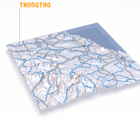 Places with similar names to Thong Tho, Vietnam ::
// Thangathe (KE)
// Thổng Thá (VN)
// Thong Thou (VN)
// Thương Tho (VN)
// Thượng Thọ (VN)
// Thượng Thọ (VN)
// Thường Thới (VN)
// Thượng Thụy (VN)
// Thượng Thủy (VN)
Disclaimer :: Information on this page comes without warranty of any kind |
||
|
Where is Thong Tho? Elevation and coordinates ::
Latitude (lat): 18°57'0"N Longitude (lon): 105°8'0"E
Elevation (approx.): 21m (map arrows pan, magnifying glasses zoom) |
||
|
Visiting Thong Tho? Hotel/Accommodation ::
Book a hotel in Thong Tho Travel Guide ::
Buy a travel guide for Vietnam rental cars ::
car rental offers GPS waypoint ::
download a GPX waypoint (PoI) of Thong Tho for your GPS receiver
|
||