|
search place name
|
||
Thong Tien Loung (Cao Bằng, Vietnam)Thong Tien Loung is a town in the Cao Bằng region of Vietnam. An overview map of the region around Thong Tien Loung is displayed below.
regional and 3d topo map of Thong Tien Loung, Vietnam ::

Thong Tien Loung airports ::
The nearest airport is HAN - Hanoi Noibai Intl, located 178.5 km south of Thong Tien Loung.
Nearby towns ::
Nam Que (1.7km west) //
Kouei Yung (1.9km north) //
Pa Khao (2.5km north east) //
Nang Kho (2.5km north east) //
Loung Xeo (4.1km north east) //
Houen Lou (5.0km south east) //
Kiao Xa Ping (5.0km north east) //
Loung Rac (5.8km north) //
Làng Cốc Phát (5.4km east) //
Pia Phang (6.5km north west) //
Phin Pao (6.3km south west) //
Ping Sion (6.5km north east) //
Pa Gai (6.3km north west) //
Nam Ruang (7.6km south) //
Nam Pa (7.6km south) //
Tsin Ping (7.1km east) //
No Leou Ping (7.1km east) //
Lòn Phinh (7.1km east) //
Làng Line (8.2km south east) //
Loung Kuang (8.2km north west) //
Sia Loung (1) (8.8km south east) //
Làng Siang (8.8km south east) //
Coc Khê (10.1km south west) //
Phinh Kouei (10.1km south west) //
Kouei Ouei (10.1km north west) //
Nám Giựa (10.1km north east) //
[all distances 'as the bird flies' and approximate] 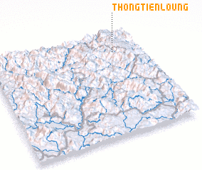 Places with similar names to Thong Tien Loung, Vietnam :: Disclaimer :: Information on this page comes without warranty of any kind |
||
|
Where is Thong Tien Loung? Elevation and coordinates ::
Latitude (lat): 22°50'0"N Longitude (lon): 105°50'0"E
Elevation (approx.): 1501m (map arrows pan, magnifying glasses zoom) |
||
|
Visiting Thong Tien Loung? Hotel/Accommodation ::
Book a hotel in Thong Tien Loung Travel Guide ::
Buy a travel guide for Vietnam rental cars ::
car rental offers GPS waypoint ::
download a GPX waypoint (PoI) of Thong Tien Loung for your GPS receiver
|
||