|
search place name
|
||
Tong Moc (Bắc Thái, Vietnam)Tong Moc is a town in the Bắc Thái region of Vietnam. An overview map of the region around Tong Moc is displayed below.
regional and 3d topo map of Tong Moc, Vietnam ::

Tong Moc airports ::
The nearest airport is HAN - Hanoi Noibai Intl, located 132.4 km south of Tong Moc.
Nearby towns ::
Hạ Hiệu (1.9km north) //
Coue Zueuil (2.5km north west) //
Na Kei (3.4km east) //
Bản Va (3.9km north east) //
Na Nao (4.1km south west) //
Bản Han (5.5km west) //
Bản Loung (5.8km south) //
Tien Dien (5.8km north) //
Pac Phuong (5.5km west) //
Na Pa (5.5km east) //
Na Fac (6.5km south east) //
Nam Linh (6.3km south west) //
Na Young (6.3km south east) //
Na Pai (6.9km east) //
Bản Foc (6.9km east) //
Bản Pan (6.9km east) //
Coc Bo (7.6km north) //
Pien Phuong (7.6km south) //
Na Pey (7.1km west) //
Kouei Pouc (7.6km south east) //
Tom Tien (7.6km north east) //
Bản Ho (8.2km south west) //
Bản Hon (7.8km north west) //
Na Kouan (7.8km south east) //
Bản Lang (7.8km south east) //
Loung Vien (9.0km north east) //
Kouei Hoan (9.0km south west) //
Pieng Cam (8.8km south west) //
Bản Kai (9.0km south east) //
[all distances 'as the bird flies' and approximate] 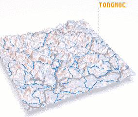 Places with similar names to Tong Moc, Vietnam ::
// Tangmai Ga (MM)
// Taunggamauk (MM)
// Taungmauk (MM)
// Taungmauk (MM)
// Taungmauk (MM)
// Dîncu Mic (RO)
// Dîngău Mic (RO)
// Dongo-Moke (CD)
// Tangambuka (CD)
// Dongo-Moké (CG)
Disclaimer :: Information on this page comes without warranty of any kind |
||
|
Where is Tong Moc? Elevation and coordinates ::
Latitude (lat): 22°25'0"N Longitude (lon): 105°51'0"E
Elevation (approx.): 208m (map arrows pan, magnifying glasses zoom) |
||
|
Visiting Tong Moc? Hotel/Accommodation ::
Book a hotel in Tong Moc Travel Guide ::
Buy a travel guide for Vietnam rental cars ::
car rental offers GPS waypoint ::
download a GPX waypoint (PoI) of Tong Moc for your GPS receiver
|
||