|
search place name
|
||
Trại Khe Sái (Vietnam)Trại Khe Sái is a town in Vietnam. An overview map of the region around Trại Khe Sái is displayed below.
regional and 3d topo map of Trại Khe Sái, Vietnam ::
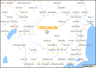
Nearby towns ::
Xuân Lộc (3.7km south) //
Tiên Ðôi (4.1km south east) //
Phong Hậu (4.1km south east) //
Hữu Vĩnh (4.0km south east) //
Phú Mý (4.0km south east) //
Quang Phong (5.3km west) //
Ngọc Diễm (1) (5.6km south) //
Ngọc Chi (5.8km south) //
Thọ Trâng (5.8km south) //
Thạch Can (6.6km south east) //
Cầu Giát (6.6km south east) //
Mỹ Hộa (6.6km south east) //
Bào Hậu (6.4km south east) //
Trang Mới (6.4km north east) //
Tràng Hộ (6.4km north east) //
Tam Lễ (7.0km west) //
Trung Lập (7.4km south) //
Bền Nghè (7.4km north) //
Ðồng Ãi (7.6km north) //
Ðất Thịt (7.6km north) //
Yên Chu (7.6km south) //
Xóm Trại Voi (7.2km west) //
Xóm Côn Ðất (7.2km west) //
Cao Hậu Ðông (7.6km south) //
Bến Ngàn (7.6km north) //
Nhân Son (1) (7.6km south east) //
Ðồng Bài (8.2km south east) //
Ðồng Bến (8.2km south east) //
Yên Hâu (9.1km south west) //
[all distances 'as the bird flies' and approximate] 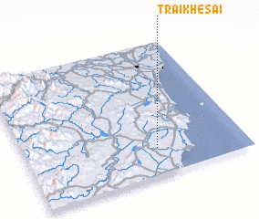 Places with similar names to Trại Khe Sái, Vietnam ::
// Dar Khīzū (IR)
// Darreh Khaşī (IR)
// Daroh Khās (IN)
// Deorī Khās (IN)
// Tarkhāş (IR)
// Turi Khuz (PK)
Disclaimer :: Information on this page comes without warranty of any kind |
||
|
Where is Trại Khe Sái? Elevation and coordinates ::
Latitude (lat): 19°12'0"N Longitude (lon): 105°36'0"E
Elevation (approx.): 53m (map arrows pan, magnifying glasses zoom) |
||
|
Visiting Trại Khe Sái? Hotel/Accommodation ::
Book a hotel in Trại Khe Sái Travel Guide ::
Buy a travel guide for Vietnam rental cars ::
car rental offers GPS waypoint ::
download a GPX waypoint (PoI) of Trại Khe Sái for your GPS receiver
|
||