|
search place name
|
||
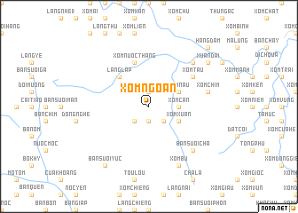
Xóm Ngoan (Vĩnh Phú, Vietnam)Xóm Ngoan is a town in the Vĩnh Phú region of Vietnam. An overview map of the region around Xóm Ngoan is displayed below.
regional and 3d topo map of Xóm Ngoan, Vietnam ::
Xóm Ngoan airports ::
The nearest airport is HAN - Hanoi Noibai Intl, located 86.3 km east of Xóm Ngoan.
Nearby towns ::
Bản Suối Gian (1.9km north) //
Xóm Nước (1.9km north) //
Xóm Nhuong (1.9km south) //
Xóm Lang (2.5km south west) //
Xóm Chiêng (2.5km south east) //
Xóm Can (3.5km east) //
Xóm Nâu (3.9km north east) //
Xóm Xuân (3.9km south east) //
Làng Lập (5.1km north west) //
Xóm Nước Thang (5.8km north) //
Xóm Nước Hậu (5.8km north) //
Xóm Tâu (6.4km north east) //
Xóm Chim (7.2km east) //
Bui Lua (7.2km east) //
Bản Suối Cha (7.6km south east) //
Xóm Chiềm (7.6km north east) //
Xóm Bu (8.2km south east) //
Làng Vi (8.2km south east) //
Bản Suối Yuc (9.0km south west) //
Xóm Cố (8.9km north east) //
Xuân Ðài (8.9km north east) //
Hang Ðam (10.1km north east) //
[all distances 'as the bird flies' and approximate] 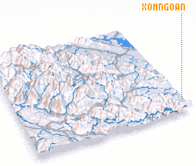 Places with similar names to Xóm Ngoan, Vietnam ::
// Samungon (MM)
// Simānagāon (IN)
// Sembianggin (ID)
// Samangān (IR)
// Samangān (IR)
// Samangān (IR)
// Zamīn Kān (IR)
// Sam Ngaien (GM)
// Sambang-ni (KP)
// Sambong-ni (KP)
Disclaimer :: Information on this page comes without warranty of any kind |
||
|
Where is Xóm Ngoan? Elevation and coordinates ::
Latitude (lat): 21°7'0"N Longitude (lon): 104°59'0"E
Elevation (approx.): 182m (map arrows pan, magnifying glasses zoom) |
||
|
Visiting Xóm Ngoan? Hotel/Accommodation ::
Book a hotel in Xóm Ngoan Travel Guide ::
Buy a travel guide for Vietnam rental cars ::
car rental offers GPS waypoint ::
download a GPX waypoint (PoI) of Xóm Ngoan for your GPS receiver
|
||