|
search place name
|
||
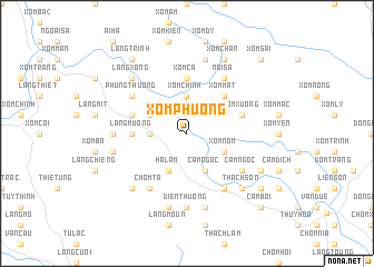
Xóm Phương (Thanh Hóa, Vietnam)Xóm Phương is a town in the Thanh Hóa region of Vietnam. An overview map of the region around Xóm Phương is displayed below.
regional and 3d topo map of Xóm Phương, Vietnam ::
Xóm Phương airports ::
The nearest airport is HAN - Hanoi Noibai Intl, located 114.2 km north east of Xóm Phương.
Nearby towns ::
Làng Lương (3.5km west) //
Xóm Chinh (3.7km north) //
Xóm Nôm (3.9km south east) //
Ha Lãm (4.1km south west) //
Thạch Lũ (3.9km north west) //
Cam Chù (4.1km south east) //
Cam Chèn (4.1km south east) //
Cam Ngọc (4.1km south east) //
Xóm Mât (5.1km north east) //
Làng Mương (5.2km west) //
Xóm Cã (5.6km north) //
Bàn Ðào (5.5km west) //
Xóm Xương (5.5km east) //
Chòm Ta (6.6km south west) //
Cam Chiêng (6.6km south east) //
Nội Sá (6.6km north east) //
Cam Ngọc (6.4km south east) //
Phụng Thượng (6.4km north west) //
Ðiền Thượng (7.4km south) //
Làng Chiêm (7.0km west) //
Ðiền Hạ (7.6km south) //
Cam Búa (7.6km south) //
Cầm Thượng (7.6km south) //
Làng Ấm (7.2km west) //
Xóm Biên (7.6km north) //
Cam Ðán (7.6km south west) //
Làng Xong (7.6km north west) //
Thạch Sơn (7.6km south east) //
Cam Bai (7.9km south east) //
[all distances 'as the bird flies' and approximate] 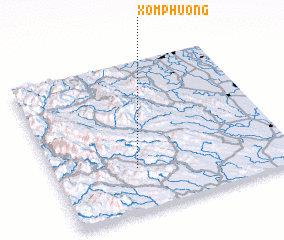 Places with similar names to Xóm Phương, Vietnam ::
// Zimovniki (RU)
// Simfunka (ZM)
// Sao Mo Phing (VN)
// Xóm Bào Phong (VN)
// Xóm Phương (VN)
// Xóm Ván Ngừa (VN)
// Xóm Vung (VN)
// Xóm Vương (VN)
// Xóm Vàng (VN)
// Xiaomafang (CN)
Disclaimer :: Information on this page comes without warranty of any kind |
||
|
Where is Xóm Phương? Elevation and coordinates ::
Latitude (lat): 20°17'0"N Longitude (lon): 105°21'0"E
Elevation (approx.): 39m (map arrows pan, magnifying glasses zoom) |
||
|
Visiting Xóm Phương? Hotel/Accommodation ::
Book a hotel in Xóm Phương Travel Guide ::
Buy a travel guide for Vietnam rental cars ::
car rental offers GPS waypoint ::
download a GPX waypoint (PoI) of Xóm Phương for your GPS receiver
|
||