|
search place name
|
||
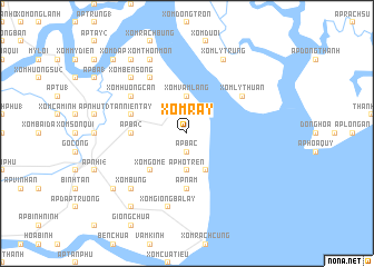
Xóm Rẫy (Tiền Giang, Vietnam)Xóm Rẫy is a town in the Tiền Giang region of Vietnam. An overview map of the region around Xóm Rẫy is displayed below.
regional and 3d topo map of Xóm Rẫy, Vietnam ::
Xóm Rẫy airports ::
The nearest airport is SGN - Ho Chi Minh City Tansonnhat Intl, located 49.8 km north of Xóm Rẫy.
Other airports nearby include PNH - Phnom-penh Phnom Penh Intl (246.4 km north west), Nearby towns ::
Ấp Bắc (1.9km south) //
Xóm Ðôi Ma (1.9km north) //
Ấp Hồ Trên (3.7km south) //
Xóm Vàm Láng (3.7km north) //
Ấp Ðông (4.1km south east) //
Xóm Gò Me (5.2km south west) //
Ấp Ba (2) (5.5km west) //
Ấp Nam (5.6km south) //
Tân Niên Tây (5.8km west) //
Xóm Hương Cấn (6.6km north west) //
Ấp Trung (2) (6.6km north west) //
Xóm Lỳ Thuận (6.6km north east) //
Xóm Ðội Ngoại (6.6km north west) //
Gia Thuận (6.6km north west) //
Giồng Bà Lẩy (7.6km south) //
Xóm Giồng Bà Lẩy (7.6km south) //
Xóm Bên Sông (7.8km north west) //
Xóm Bưng (7.8km south west) //
Xóm Lý Trung (8.3km north east) //
Xóm Thôn Môn (8.3km north west) //
Hòa Lạc (9.2km south west) //
Xóm Nhi Só (9.2km north west) //
Ấp Giòng (9.2km south west) //
Xóm Ðập (10.4km north west) //
[all distances 'as the bird flies' and approximate] 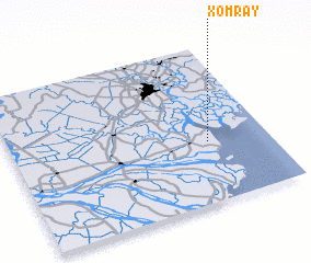 Places with similar names to Xóm Rẫy, Vietnam ::
Disclaimer :: Information on this page comes without warranty of any kind |
||
|
Where is Xóm Rẫy? Elevation and coordinates ::
Latitude (lat): 10°23'0"N Longitude (lon): 106°46'0"E
Elevation (approx.): -2m (map arrows pan, magnifying glasses zoom) |
||
|
Visiting Xóm Rẫy? Hotel/Accommodation ::
Book a hotel in Xóm Rẫy Travel Guide ::
Buy a travel guide for Vietnam rental cars ::
car rental offers GPS waypoint ::
download a GPX waypoint (PoI) of Xóm Rẫy for your GPS receiver
|
||