|
search place name
|
||
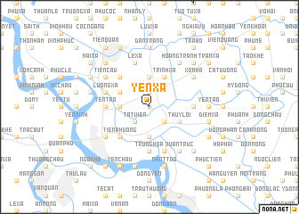
Yen Xá (Hải Hưng, Vietnam)Yen Xá is a town in the Hải Hưng region of Vietnam. An overview map of the region around Yen Xá is displayed below.
regional and 3d topo map of Yen Xá, Vietnam ::
Yen Xá airports ::
The nearest airport is HAN - Hanoi Noibai Intl, located 67.7 km north west of Yen Xá.
Nearby towns ::
Dị Chế (0.0km north) //
Tiên Xá (1.9km north) //
Hai Yen (2.5km south east) //
Tát Viên (2.5km south west) //
An Phương (3.7km south) //
Ðào Ðặng (3.5km west) //
Thiên Xuân (3.7km north) //
Thụy Lôi (3.9km south east) //
Trình Xá (4.1km north east) //
Linh Hạ (3.9km north west) //
Tiên Phương (5.1km south west) //
Hậu Xá (5.1km north west) //
Canh Hoạch (5.2km east) //
Hoàng Xá (5.2km east) //
Yèn Tao (5.2km west) //
Trung Hòa (5.6km south) //
Tiên Thôn (5.6km south) //
Phu Ha (5.8km south) //
Lương Xá (5.5km west) //
An Thi (5.8km north) //
Lê Xa (5.8km north) //
Hưng Yên (6.4km south west) //
Hoàng Tranh (6.6km north east) //
Xuân Truc (6.6km south east) //
Ðông Cáp (6.4km north east) //
Xóm Ha (6.4km north east) //
Tiên Cầu (6.4km north west) //
Yên Tào (6.9km east) //
Ðan Tràng (7.4km north) //
[all distances 'as the bird flies' and approximate] 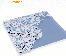 Places with similar names to Yen Xá, Vietnam ::
Disclaimer :: Information on this page comes without warranty of any kind |
||
|
Where is Yen Xá? Elevation and coordinates ::
Latitude (lat): 20°41'0"N Longitude (lon): 106°7'0"E
Elevation (approx.): 1m (map arrows pan, magnifying glasses zoom) |
||
|
Visiting Yen Xá? Hotel/Accommodation ::
Book a hotel in Yen Xá Travel Guide ::
Buy a travel guide for Vietnam rental cars ::
car rental offers GPS waypoint ::
download a GPX waypoint (PoI) of Yen Xá for your GPS receiver
|
||