|
search place name
|
||
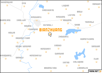
Bianzhuang (Anhui, China)Bianzhuang is a town in the Anhui region of China. An overview map of the region around Bianzhuang is displayed below.
regional and 3d topo map of Bianzhuang, China ::
Bianzhuang airports ::
The nearest airport is HFE - Hefei Luogang, located 125.5 km south west of Bianzhuang.
Other airports nearby include NKG - Nanjing Lukou (134.3 km south east), Nearby towns ::
Putangli (3.1km north) //
Gutangli (3.5km north west) //
Zhougang (4.1km east) //
Xiaowei (5.0km south east) //
Hengshan (5.8km south) //
Shangao (5.4km west) //
Mingdong (6.9km north east) //
Houwang (7.1km north east) //
Mingguang (7.5km north west) //
Guandian (7.9km south) //
Xiaoxugang (8.6km north) //
Magang (7.5km west) //
Hengshanji (9.3km south west) //
Dongpan (8.7km south west) //
Liuying (9.4km north east) //
[all distances 'as the bird flies' and approximate]  Places with similar names to Bianzhuang, China ::
// Ban Sa Hong (TH)
// Ban Sai Hong (TH)
// Ban Sai Hong (TH)
// Ban Sao Hong (TH)
// Ban Sao Hong (TH)
// Bao'anzhuang (CN)
// Bản Suối Hang (VN)
// Banzhuang (CN)
// Benzhuang (CN)
// Bianzhuang (CN)
Disclaimer :: Information on this page comes without warranty of any kind |
||
|
Where is Bianzhuang? Elevation and coordinates ::
Latitude (lat): 32°43'32"N Longitude (lon): 118°1'50"E
Elevation (approx.): 49m (map arrows pan, magnifying glasses zoom) |
||
|
Visiting Bianzhuang? Hotel/Accommodation ::
Book a hotel in Bianzhuang Travel Guide ::
Buy a travel guide for China rental cars ::
car rental offers GPS waypoint ::
download a GPX waypoint (PoI) of Bianzhuang for your GPS receiver
|
||