|
search place name
|
||
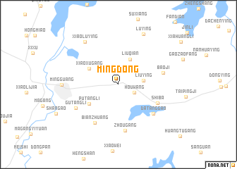
Mingdong (Anhui, China)Mingdong is a town in the Anhui region of China. An overview map of the region around Mingdong is displayed below.
regional and 3d topo map of Mingdong, China ::
Mingdong airports ::
The nearest airport is HFE - Hefei Luogang, located 132.3 km south west of Mingdong.
Other airports nearby include NKG - Nanjing Lukou (137.5 km south east), Nearby towns ::
Houwang (2.4km south east) //
Liuying (3.4km east) //
Liuqian (4.3km north) //
Xiaoxugang (4.6km north west) //
Putangli (5.0km south west) //
Shiba (6.0km south east) //
Bianzhuang (6.9km south west) //
Datanggao (6.6km south east) //
Zhougang (7.3km south) //
Baoji (6.3km east) //
Gutangli (6.8km south west) //
Xiaoluying (8.1km north west) //
Lüying (8.7km north east) //
[all distances 'as the bird flies' and approximate] 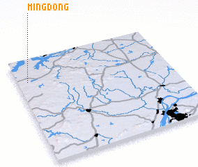 Places with similar names to Mingdong, China ::
// Maingdaung (MM)
// Manaogahtawng (MM)
// Mangtong (MM)
// Mān Kiu-htang (MM)
// Maungdaung (MM)
// Maungdaung (MM)
// Meungtung (MM)
// Mōng Tong (MM)
// Möng Tung (MM)
// Möng Tawng (MM)
Disclaimer :: Information on this page comes without warranty of any kind |
||
|
Where is Mingdong? Elevation and coordinates ::
Latitude (lat): 32°46'50"N Longitude (lon): 118°3'50"E
Elevation (approx.): 54m (map arrows pan, magnifying glasses zoom) |
||
|
Visiting Mingdong? Hotel/Accommodation ::
Book a hotel in Mingdong Travel Guide ::
Buy a travel guide for China rental cars ::
car rental offers GPS waypoint ::
download a GPX waypoint (PoI) of Mingdong for your GPS receiver
|
||