|
search place name
|
||
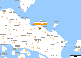
Hongjia (Zhejiang, China)Hongjia is a town in the Zhejiang region of China. An overview map of the region around Hongjia is displayed below.
regional and 3d topo map of Hongjia, China ::
Hongjia airports ::
The nearest airport is NGB - Ninbo Lishe, located 78.5 km west of Hongjia.
Other airports nearby include SHA - Shanghai Hongqiao Intl (151.4 km north west), HGH - Hangzhou Xiaoshan (173.5 km west), Nearby towns ::
Beichan (0.7km west) //
Huangsha (1.3km north) //
Hejia (1.3km north west) //
Xiaozhan (1.5km south) //
Xitianshe (2.3km south east) //
Haikou (2.2km east) //
Xiaoyuanshan (2.6km north) //
Diaomen (2.9km north) //
Fangjia (2.5km west) //
Mazhi (2.7km north west) //
Longtang (3.0km south) //
Shenjia (3.6km south east) //
Aodichen (3.5km south west) //
Shuiguankou (3.8km west) //
Gaoxie (4.3km south west) //
Yangjia (4.6km south west) //
Shagenli (4.2km west) //
Shangfen (4.2km west) //
Nijia (4.9km south) //
Luomen (4.9km east) //
Pansun (5.4km south east) //
Quanjia (5.5km south west) //
Dongʼao (6.1km south) //
Tangjia'ao (5.6km north west) //
Donghu (5.6km west) //
Langxi (5.9km north west) //
Chaomian (6.0km south west) //
Xiaohemei (6.1km west) //
Xujia (6.7km south west) //
[all distances 'as the bird flies' and approximate] 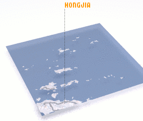 Places with similar names to Hongjia, China ::
// Hongji (KP)
// Hongji (KR)
// Hŭngji (KR)
// Huangjia (CN)
// Huangjia'ao (CN)
// Huangjia'ao (CN)
// Huangjia'ao (CN)
// Hinokage (JP)
// Hangji (CN)
// Hengji (CN)
Disclaimer :: Information on this page comes without warranty of any kind |
||
|
Where is Hongjia? Elevation and coordinates ::
Latitude (lat): 30°4'9"N Longitude (lon): 122°13'33"E
Elevation (approx.): 24m (map arrows pan, magnifying glasses zoom) |
||
|
Visiting Hongjia? Hotel/Accommodation ::
Book a hotel in Hongjia Travel Guide ::
Buy a travel guide for China rental cars ::
car rental offers GPS waypoint ::
download a GPX waypoint (PoI) of Hongjia for your GPS receiver
|
||