|
search place name
|
||
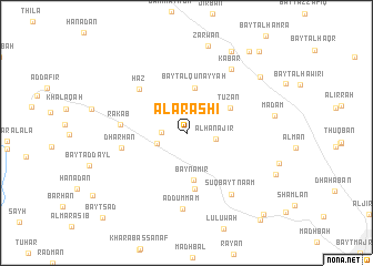
Al ‘Arashī (Yemen)Al ‘Arashī is a town in Yemen. An overview map of the region around Al ‘Arashī is displayed below.
regional and 3d topo map of Al ‘Arashī, Yemen ::
Al ‘Arashī airports ::
The nearest airport is GIZ - Gizan King Abdullah Bin Abdulaziz, located 221.7 km north west of Al ‘Arashī.
Nearby towns ::
Al Munaqqab (2.5km west) //
Al Qurayshī (2.9km north) //
Al Hanājir (2.9km east) //
Rayshān Banī Maţar (3.0km west) //
Bayt al Qunayyah (4.6km north) //
Bayn ‘Āmir (4.8km south) //
Ţūz̧ān (4.9km north east) //
Qarātīl (5.7km south) //
Ḩāz (6.3km north west) //
Dharḩān (6.4km west) //
Rakab (6.5km west) //
Ad Dummam (7.6km south) //
Sūq Bayt Na‘am (7.5km south east) //
Kabār (7.7km north east) //
Z̧arwān (9.0km north) //
Madām (8.7km east) //
Al Ma‘mar (9.1km north east) //
Ḑirwān (9.3km north east) //
Bayt an Na‘ām (10.3km north east) //
Bayt adh Dhafīf (10.8km north east) //
Qaryat al Muşallī (11.1km south east) //
Rayshān (11.2km south east) //
Bayt Sa‘d (11.8km south west) //
[all distances 'as the bird flies' and approximate]  Places with similar names to Al ‘Arashī, Yemen ::
// Alarcia (ES)
// Al ‘Arīsh (EG)
// Al ‘Arīsh (LB)
// Al ‘Orosh (SA)
// Al ‘Arāʼish (SD)
// Al ‘Arāʼish (SD)
// Al ‘Arshah (SD)
// Al ‘Arīsh (QA)
// Al ‘Arīsh (YE)
// Al ‘Ursh (YE)
Disclaimer :: Information on this page comes without warranty of any kind |
||
|
Where is Al ‘Arashī? Elevation and coordinates ::
Latitude (lat): 15°28'33"N Longitude (lon): 44°2'35"E
Elevation (approx.): 2689m (map arrows pan, magnifying glasses zoom) |
||
|
Visiting Al ‘Arashī? Hotel/Accommodation ::
Book a hotel in Al ‘Arashī Travel Guide ::
Buy a travel guide for Yemen rental cars ::
car rental offers GPS waypoint ::
download a GPX waypoint (PoI) of Al ‘Arashī for your GPS receiver
|
||