|
search place name
|
||
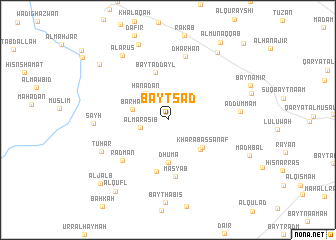
Bayt Sa‘d (Yemen)Bayt Sa‘d is a town in Yemen. An overview map of the region around Bayt Sa‘d is displayed below.
regional and 3d topo map of Bayt Sa‘d, Yemen ::
Bayt Sa‘d airports ::
The nearest airport is GIZ - Gizan King Abdullah Bin Abdulaziz, located 222.4 km north west of Bayt Sa‘d.
Nearby towns ::
Al Lakamah (2.4km north west) //
Al Marāşib (3.1km west) //
Ḩanaḑān (3.8km north west) //
Barḩān (4.0km west) //
Dhūmā (4.8km south) //
Kharāb as Sanaf (4.8km south east) //
Kharāb as Sanaf (4.8km south east) //
Bayt ad Dayl (5.4km north) //
Bayt al Yisrī (5.8km south) //
Masyab (6.4km south) //
Radmān (6.6km south west) //
Dharḩān (7.4km north) //
Ad Dummam (7.8km east) //
Tuhar (8.0km south west) //
Şayḩ (8.0km west) //
Al ‘Arūs (8.7km north west) //
Az̧ Z̧afīr (9.0km north) //
Rayshān Banī Maţar (9.3km north east) //
Aş Şaraḩah (9.6km north west) //
Al Qufl (9.8km south west) //
Al Jalb (10.2km south west) //
Al Munaqqab (10.4km north east) //
Al ‘Arashī (11.8km north east) //
[all distances 'as the bird flies' and approximate]  Places with similar names to Bayt Sa‘d, Yemen ::
// Bautista (PH)
// Bautista (PH)
// Bautista (PH)
// Bautista (PH)
// Bautista (PH)
// Butte City (US)
// Butte City (US)
// Båtstø (NO)
// Biedźiadów (PL)
// Batista (CU)
Disclaimer :: Information on this page comes without warranty of any kind |
||
|
Where is Bayt Sa‘d? Elevation and coordinates ::
Latitude (lat): 15°23'55"N Longitude (lon): 43°58'1"E
Elevation (approx.): 2759m (map arrows pan, magnifying glasses zoom) |
||
|
Visiting Bayt Sa‘d? Hotel/Accommodation ::
Book a hotel in Bayt Sa‘d Travel Guide ::
Buy a travel guide for Yemen rental cars ::
car rental offers GPS waypoint ::
download a GPX waypoint (PoI) of Bayt Sa‘d for your GPS receiver
|
||