|
search place name
|
||
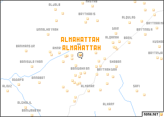
Al Maḩaţţah (Yemen)Al Maḩaţţah is a town in Yemen. An overview map of the region around Al Maḩaţţah is displayed below.
regional and 3d topo map of Al Maḩaţţah, Yemen ::
Al Maḩaţţah airports ::
The nearest airport is GIZ - Gizan King Abdullah Bin Abdulaziz, located 235.5 km north west of Al Maḩaţţah.
Nearby towns ::
Al Maḩaţţah (1.9km north) //
Raymah (2.2km south west) //
Bayt al Jiddī (2.2km west) //
Al Ḩayfah (2.3km west) //
Al Ma‘īnah (3.4km south) //
Al Qalīs (3.3km north east) //
Banī Dahmān (3.4km south) //
Al Mi‘zāb (3.3km west) //
Al Maʼkhadh (3.6km west) //
Qamlān (3.7km south east) //
Qārat Banī Suwār (3.7km east) //
Bayt Umm Jallī (4.1km south) //
Ḩişn Banī Sulaymān (4.2km south) //
Al Ya‘ar (4.2km west) //
Bayt al Mifḑal (4.4km south east) //
Baw‘ān (4.9km south east) //
Sūq Bū‘ān (5.0km east) //
Amrash (5.2km west) //
Bayt ar Rumaym (5.5km south) //
Bayt az Zūwār (5.7km south) //
Dār al Mawrid (5.8km south) //
Bayt as Suwaydī (6.0km south) //
Bayt Mahdam (6.7km south east) //
Al Hijrah (6.8km west) //
Al ‘Urr (7.2km west) //
Al Manār (7.6km south) //
Al Qadhaf (7.5km east) //
Bayt az Zubdānī (7.7km south west) //
Al Qārah (7.7km north east) //
[all distances 'as the bird flies' and approximate] 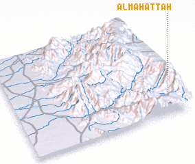 Places with similar names to Al Maḩaţţah, Yemen ::
// Al Muḩawwaţah (IQ)
// Al Maḩaţţah (LB)
// Al Maḩaţţah (SA)
// Al Maḩaţţah (JO)
// Al Maḩaţţah (OM)
// Al Maḩadah (YE)
// Al Maḩaţţah (LB)
// Al Maḩaţţah (LB)
// Al Maḩaţţah (LB)
// Alambihud (PH)
Disclaimer :: Information on this page comes without warranty of any kind |
||
|
Where is Al Maḩaţţah? Elevation and coordinates ::
Latitude (lat): 15°14'1"N Longitude (lon): 43°57'12"E
Elevation (approx.): 3045m (map arrows pan, magnifying glasses zoom) |
||
|
Visiting Al Maḩaţţah? Hotel/Accommodation ::
Book a hotel in Al Maḩaţţah Travel Guide ::
Buy a travel guide for Yemen rental cars ::
car rental offers GPS waypoint ::
download a GPX waypoint (PoI) of Al Maḩaţţah for your GPS receiver
|
||