|
search place name
|
||
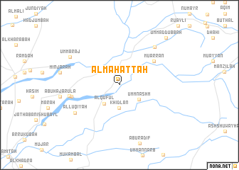
Al Maḩaţţah (Jīzān, Saudi Arabia)Al Maḩaţţah is a town in the Jīzān region of Saudi Arabia. An overview map of the region around Al Maḩaţţah is displayed below.
regional and 3d topo map of Al Maḩaţţah, Saudi Arabia ::
Al Maḩaţţah airports ::
The nearest airport is GIZ - Gizan King Abdullah Bin Abdulaziz, located 59.3 km west of Al Maḩaţţah.
Other airports nearby include EAM - Nejran (172.8 km north east), AHB - Abha (176.9 km north), Nearby towns ::
Khidlan (3.6km south) //
Al Qufūl (3.7km south west) //
Umm Nashm (3.7km south east) //
Mu‘arran (6.5km north east) //
Abū Kirsh (7.4km west) //
Abū Ḩajar al A‘lá (7.8km west) //
Mundaraq (8.0km north east) //
Al Luqīyah (8.0km south west) //
Umm ‘Araj (8.6km north west) //
Umm ad Dubbah (10.2km north east) //
[all distances 'as the bird flies' and approximate] 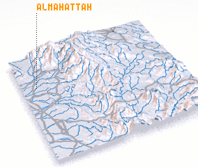 Places with similar names to Al Maḩaţţah, Saudi Arabia ::
// Al Muḩawwaţah (IQ)
// Al Maḩaţţah (LB)
// Al Maḩaţţah (JO)
// Al Maḩaţţah (OM)
// Al Maḩadah (YE)
// Al Maḩaţţah (LB)
// Al Maḩaţţah (LB)
// Al Maḩaţţah (LB)
// Al Maḩaţţah (YE)
// Alambihud (PH)
Disclaimer :: Information on this page comes without warranty of any kind |
||
|
Where is Al Maḩaţţah? Elevation and coordinates ::
Latitude (lat): 16°41'58"N Longitude (lon): 43°6'3"E
Elevation (approx.): 142m (map arrows pan, magnifying glasses zoom) |
||
|
Visiting Al Maḩaţţah? Hotel/Accommodation ::
Book a hotel in Al Maḩaţţah Travel Guide ::
rental cars ::
car rental offers GPS waypoint ::
download a GPX waypoint (PoI) of Al Maḩaţţah for your GPS receiver
|
||