|
search place name
|
||
Al Maḩwá (‘Adan, Yemen)Al Maḩwá is a town in the ‘Adan region of Yemen. An overview map of the region around Al Maḩwá is displayed below.
regional and 3d topo map of Al Maḩwá, Yemen ::

Nearby towns ::
Dayr aş Şamīl (0.4km south west) //
Aş Şanīf (0.8km north east) //
Al Lijām (1.3km north) //
Dayr Sīb ‘Alī (1.4km south) //
Abubertan (1.8km east) //
Al Mahalabe (1.8km west) //
Makīn (2.6km north west) //
Al Jirb (2.7km south east) //
Al Maḩwá (3.0km north east) //
Al Maţāḩin (2.9km east) //
Al Kidf (2.9km south east) //
Al Kathīr (3.1km west) //
Ţimţām (3.2km west) //
Al Kalaḩah (3.4km south west) //
Al Ghuzzīyah (3.5km south west) //
Al Jarūb (3.8km north west) //
Al Jurūb (3.9km south east) //
Ḩumāsīyah (4.1km south) //
Om Mari (4.1km south west) //
Buyūt al Maḩādibah (4.2km south west) //
Al Ghāwī (4.2km north west) //
Quz‘at al Masātīr (4.2km south east) //
Al Ḩajb (4.6km north) //
‘Uruf (4.5km east) //
Buyūt al Başābiş (4.7km south west) //
Al Janbaʼīyah (4.8km east) //
Ash Shaţţ (5.0km south east) //
Al Qūza‘ (5.0km east) //
Al ‘Ayrīyah (5.1km south east) //
[all distances 'as the bird flies' and approximate] 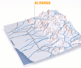 Places with similar names to Al Maḩwá, Yemen ::
Disclaimer :: Information on this page comes without warranty of any kind |
||
|
Where is Al Maḩwá? Elevation and coordinates ::
Latitude (lat): 14°38'0"N Longitude (lon): 43°25'0"E
Elevation (approx.): 171m (map arrows pan, magnifying glasses zoom) |
||
|
Visiting Al Maḩwá? Hotel/Accommodation ::
Book a hotel in Al Maḩwá Travel Guide ::
Buy a travel guide for Yemen rental cars ::
car rental offers GPS waypoint ::
download a GPX waypoint (PoI) of Al Maḩwá for your GPS receiver
|
||