|
search place name
|
||
Dayr Sīb ‘Alī (Al Ḩudaydah, Yemen)Dayr Sīb ‘Alī is a town in the Al Ḩudaydah region of Yemen. An overview map of the region around Dayr Sīb ‘Alī is displayed below.
regional and 3d topo map of Dayr Sīb ‘Alī, Yemen ::
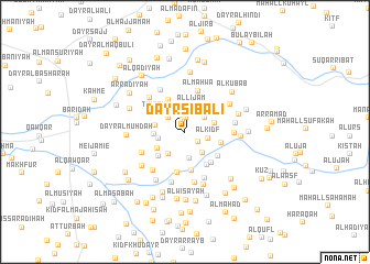
Nearby towns ::
Dayr aş Şamīl (1.2km north) //
Al Maḩwá (1.4km north) //
Al Jirb (1.6km south east) //
Aş Şanīf (2.2km north) //
Al Mahalabe (2.2km north west) //
Al Kidf (2.3km east) //
Abubertan (2.4km north east) //
Ḩumāsīyah (2.7km south) //
Al Lijām (2.7km north) //
Al Kalaḩah (2.7km west) //
Al Jurūb (2.8km south east) //
Om Mari (2.8km south west) //
Al Kathīr (2.9km west) //
Al Ghuzzīyah (3.0km west) //
Al Maţāḩin (3.1km east) //
Buyūt al Maḩādibah (3.1km south west) //
Buyūt al Başābiş (3.6km south west) //
Makīn (3.7km north west) //
Ţimţām (3.6km north west) //
Quz‘at al Masātīr (3.7km east) //
Al Jurbishīyah (3.9km south) //
Al Majrab (4.0km south east) //
Al ‘Ayrīyah (4.0km south east) //
Buyūt al Kudayshah (4.2km south) //
Ash Shaţţ (4.1km south east) //
Al Maḩwá (4.3km north) //
Dimnat al Haddārah (4.7km south west) //
Al Jarūb (4.9km north west) //
Al Qūza‘ (4.8km east) //
[all distances 'as the bird flies' and approximate] 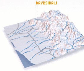 Places with similar names to Dayr Sīb ‘Alī, Yemen ::
// Trzebiel (PL)
// Trzebol (PL)
// Tresabuela (ES)
// Dar Rīz-e Bālā (IR)
// Darsawbli (LR)
// Trazibulo (BR)
// Tørsbøl (DK)
// Tråsbøl (DK)
// Tressebølle (DK)
// Töresbol (SE)
Disclaimer :: Information on this page comes without warranty of any kind |
||
|
Where is Dayr Sīb ‘Alī? Elevation and coordinates ::
Latitude (lat): 14°37'14"N Longitude (lon): 43°24'56"E
Elevation (approx.): 174m (map arrows pan, magnifying glasses zoom) |
||
|
Visiting Dayr Sīb ‘Alī? Hotel/Accommodation ::
Book a hotel in Dayr Sīb ‘Alī Travel Guide ::
Buy a travel guide for Yemen rental cars ::
car rental offers GPS waypoint ::
download a GPX waypoint (PoI) of Dayr Sīb ‘Alī for your GPS receiver
|
||