|
search place name
|
||
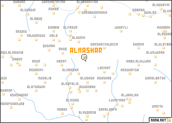
Al Ma‘shar (Ta‘izz, Yemen)Al Ma‘shar is a town in the Ta‘izz region of Yemen. An overview map of the region around Al Ma‘shar is displayed below.
regional and 3d topo map of Al Ma‘shar, Yemen ::
Nearby towns ::
Al Mushāwar (3.1km south west) //
Al Mamshá (4.2km south west) //
Al Hurīm (4.5km north) //
Al ‘Ushsh (4.6km south) //
Lakīmat (4.6km south east) //
Dār Shaykh Jazīm (4.9km north east) //
‘Amūq (5.2km west) //
Ḩārāt (5.1km west) //
Malbasat Shuwayfah (5.8km north west) //
Ash Sha‘b (6.0km south east) //
Al Harshah (6.2km south) //
Al Qubā‘ (6.4km south) //
Ad Danbah (6.4km south) //
Ar Raqab (6.3km south east) //
Najd al Rukayb (6.5km north west) //
Al Mafālīs (6.6km south west) //
Al Qurayyah (6.7km south) //
Aḑ Ḑawkah (6.7km south) //
Ḩayfān (7.2km north west) //
Al Fasur (7.3km north west) //
Ḩarwah (7.3km north west) //
Al Jawbah (7.4km south west) //
Qudmah (8.2km west) //
Wala‘ (8.3km north west) //
Ghabīb (9.5km north west) //
Juḩaylī (10.0km north east) //
[all distances 'as the bird flies' and approximate] 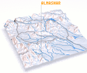 Places with similar names to Al Ma‘shar, Yemen ::
// Al Musharraḩ (IQ)
// Almáchar (ES)
// Alamshīr (IR)
// Al Mashaēr (SA)
// Al Mushīrah (SA)
// Ālam Sher (PK)
// Alam Sherī (PK)
// Ālam Sheri (PK)
// Al Mushīr (SY)
// Al Mashrū‘ (IQ)
Disclaimer :: Information on this page comes without warranty of any kind |
||
|
Where is Al Ma‘shar? Elevation and coordinates ::
Latitude (lat): 13°16'27"N Longitude (lon): 44°19'49"E
Elevation (approx.): 1242m (map arrows pan, magnifying glasses zoom) |
||
|
Visiting Al Ma‘shar? Hotel/Accommodation ::
Book a hotel in Al Ma‘shar Travel Guide ::
Buy a travel guide for Yemen rental cars ::
car rental offers GPS waypoint ::
download a GPX waypoint (PoI) of Al Ma‘shar for your GPS receiver
|
||