|
search place name
|
||
Balasān (Yemen)Balasān is a town in Yemen. An overview map of the region around Balasān is displayed below.
regional and 3d topo map of Balasān, Yemen ::
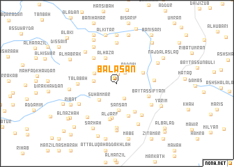
Nearby towns ::
Al Ḩarf (1.5km north) //
Ribāţ ar Rumayshī (2.1km north east) //
Hijrat ‘Abīdah (2.3km north) //
As Sārī (2.6km south east) //
Ad Dobi (2.8km north east) //
Aribe as Sūq (2.9km north west) //
Usni Bedaa (3.6km west) //
Suḩammar (3.8km south west) //
Sha‘bān (3.9km north west) //
Şanşan (4.3km south) //
Al Haza (4.4km north west) //
As Simlāl (4.4km north east) //
Dakhlat ‘Uwaydayn (5.3km south east) //
Al Barba (5.4km north west) //
Bayt as Sifyānī (5.4km east) //
Meriun (5.5km south) //
Bayt ad Du‘us (5.6km south) //
Al Jarf (5.9km south) //
Qu‘ayqi‘ān (5.8km east) //
Tālabah (6.2km west) //
‘Arab (6.4km south east) //
‘Arās (6.3km south east) //
Ḩijrah (6.5km north) //
Bā Suwayd (6.7km south west) //
Ba‘lān (6.9km north west) //
Idzan (7.1km south) //
Al Jubah (7.1km north west) //
Al Lakmah (7.1km south west) //
Ash Sharafah (7.1km north east) //
[all distances 'as the bird flies' and approximate] 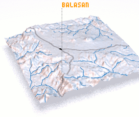 Places with similar names to Balasān, Yemen ::
Disclaimer :: Information on this page comes without warranty of any kind |
||
|
Where is Balasān? Elevation and coordinates ::
Latitude (lat): 14°19'49"N Longitude (lon): 44°19'1"E
Elevation (approx.): 2625m (map arrows pan, magnifying glasses zoom) |
||
|
Visiting Balasān? Hotel/Accommodation ::
Book a hotel in Balasān Travel Guide ::
Buy a travel guide for Yemen rental cars ::
car rental offers GPS waypoint ::
download a GPX waypoint (PoI) of Balasān for your GPS receiver
|
||