|
search place name
|
||
Al Jubah (Yemen)Al Jubah is a town in Yemen. An overview map of the region around Al Jubah is displayed below.
regional and 3d topo map of Al Jubah, Yemen ::
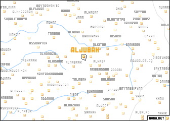
Nearby towns ::
Ba‘lān (1.5km north east) //
Al Barba (1.6km south east) //
‘Aşfirān (2.3km north east) //
Al Mabrak (2.8km south west) //
Zi Alul (2.9km north east) //
Al Haza (3.2km east) //
Al A‘kī (3.6km north west) //
Sha‘bān (3.8km south) //
Al Kitar (4.0km north east) //
Aribe as Sūq (4.2km south east) //
Dissain (4.2km west) //
Banī Hamar (4.7km north) //
Al Ḩusayn (4.7km north) //
Usni Bedaa (4.9km south) //
Ḩijrah (5.0km east) //
Tālabah (5.3km south) //
Hijrat ‘Abīdah (5.4km south east) //
Bayt al Ba‘m (5.5km north east) //
Al ‘Adan (5.9km north west) //
Al Aghiair (6.0km west) //
Al Ḩarf (6.1km south east) //
Ribāţ al Ma‘zibī (6.4km north) //
Ḑawmarān (6.4km north) //
Bayḩān (6.5km south west) //
Al Ḩiswar (6.4km west) //
Mansibah (7.0km north east) //
Balasān (7.1km south east) //
Ribāţ ar Rumayshī (7.0km south east) //
Dishunigran (7.2km east) //
[all distances 'as the bird flies' and approximate] 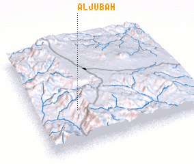 Places with similar names to Al Jubah, Yemen ::
// Al Jawb (IQ)
// Aljube (ES)
// Al Jubb (SA)
// Allāh Jābū (SD)
// Allāh Jābū (SD)
// Al Jawbah (SY)
// Al Jawbah (SY)
// Al Jibā‘ī (OM)
// Älgebo (SE)
// Al Jabī (YE)
Disclaimer :: Information on this page comes without warranty of any kind |
||
|
Where is Al Jubah? Elevation and coordinates ::
Latitude (lat): 14°22'34"N Longitude (lon): 44°16'18"E
Elevation (approx.): 2063m (map arrows pan, magnifying glasses zoom) |
||
|
Visiting Al Jubah? Hotel/Accommodation ::
Book a hotel in Al Jubah Travel Guide ::
Buy a travel guide for Yemen rental cars ::
car rental offers GPS waypoint ::
download a GPX waypoint (PoI) of Al Jubah for your GPS receiver
|
||