|
search place name
|
||
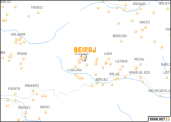
Be°iraj (Srbija, Serbia and Montenegro)Be°iraj is a town in the Srbija region of Serbia and Montenegro. An overview map of the region around Be°iraj is displayed below.
regional and 3d topo map of Be°iraj, Serbia and Montenegro ::
Be°iraj airports ::
The nearest airport is TGD - Podgorica, located 78.8 km south west of Be°iraj.
Other airports nearby include PRN - Pristina (82.2 km east), TIV - Tivat (115.9 km west), DBV - Dubrovnik (148.3 km west), TIA - Tirana Rinas (150.0 km south), Nearby towns ::
Boge (0.5km west) //
Red Boge (0.7km north west) //
Drešovi°i (0.9km south) //
Sadikovi°i (0.9km north) //
Dem Boge (1.0km north west) //
Laze (1.1km west) //
Adži°i (1.1km west) //
Husaj (1.7km east) //
Škrelje (1.8km east) //
Demaj (1.9km east) //
Jošanica (2.2km south west) //
Duge Njive (3.4km south east) //
Ljuljaj (3.5km south west) //
Cukaj (3.8km south) //
Lekaj (3.8km south) //
Adžovi°i (3.7km south) //
Guništa (3.1km south east) //
Redži°i (3.3km east) //
Košutane (3.4km east) //
Leki°i (3.8km east) //
Ku°ište (5.2km south) //
Ljuđe (4.0km east) //
Breg Ku°ište (5.2km south) //
Ðevukaj (5.6km south) //
Barlaj (5.9km south east) //
Šalja (6.2km south east) //
Pepi°i (5.8km east) //
Micinat (6.7km south east) //
Drelje (6.4km south east) //
[all distances 'as the bird flies' and approximate] 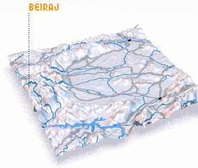 Places with similar names to Be°iraj, Serbia and Montenegro ::
Disclaimer :: Information on this page comes without warranty of any kind |
||
|
Where is Be°iraj? Elevation and coordinates ::
Latitude (lat): 42°44'28"N Longitude (lon): 20°3'36"E
Elevation (approx.): 1490m (map arrows pan, magnifying glasses zoom) |
||
|
Visiting Be°iraj? Hotel/Accommodation ::
Book a hotel in Be°iraj Travel Guide ::
rental cars ::
car rental offers GPS waypoint ::
download a GPX waypoint (PoI) of Be°iraj for your GPS receiver
|
||