|
search place name
|
||
Šutci (Srbija, Serbia and Montenegro)Šutci is a town in the Srbija region of Serbia and Montenegro. An overview map of the region around Šutci is displayed below.
regional and 3d topo map of Šutci, Serbia and Montenegro ::

Šutci airports ::
The nearest airport is BEG - Beograd, located 61.4 km north of Šutci.
Other airports nearby include INI - Nis (158.7 km south east), OSI - Osijek (180.5 km north west), TSR - Timisoara Traian Vuia (188.1 km north east), PRN - Pristina (196.1 km south), Nearby towns ::
Brajkovac (3.9km north west) //
Kalanjevci (3.5km east) //
Belanovica (3.9km south east) //
Liplje (4.0km west) //
Kozelj (6.3km south) //
Ivanovci (6.0km south west) //
Moravci (6.5km south west) //
Živkovci (6.4km east) //
Kruševica (8.2km north east) //
Štavica (9.0km south) //
Barzilovica (8.4km north west) //
Trudelj (8.8km south east) //
[all distances 'as the bird flies' and approximate] 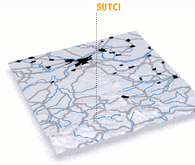 Places with similar names to Šutci, Serbia and Montenegro ::
// Sadies (MA)
// Sidi Aïssa (MA)
// Sidi Aïssa (MA)
// Sidi Aïssa (MA)
// Sidi Aïssa (MA)
// Sidi Aïssa (MA)
// Seytas (AZ)
// Satsa (MM)
// Satse (MM)
// Setzaw (MM)
Disclaimer :: Information on this page comes without warranty of any kind |
||
|
Where is Šutci? Elevation and coordinates ::
Latitude (lat): 44°16'0"N Longitude (lon): 20°21'23"E
Elevation (approx.): 282m (map arrows pan, magnifying glasses zoom) |
||
|
Visiting Šutci? Hotel/Accommodation ::
Book a hotel in Šutci Travel Guide ::
rental cars ::
car rental offers GPS waypoint ::
download a GPX waypoint (PoI) of Šutci for your GPS receiver
|
||