|
search place name
|
||
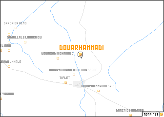
Douar Hammadi (Khemisset, Morocco)Douar Hammadi is a town in the Khemisset region of Morocco. An overview map of the region around Douar Hammadi is displayed below.
regional and 3d topo map of Douar Hammadi, Morocco ::
Douar Hammadi airports ::
The nearest airport is RBA - Rabat Sale, located 43.2 km west of Douar Hammadi.
Other airports nearby include NNA - Kentira Kenitra (47.4 km north west), MEK - Meknes Bassatine (73.0 km east), FEZ - Fez Saiss (122.2 km east), CMN - Casablanca Mohammed V Intl (136.0 km south west), Nearby towns ::
Douar Mohammed Ould Hassene (4.0km south west) //
Douar Sidi Mohammed (4.6km west) //
Tiflet (6.4km south west) //
Douar Hammadou Saïd (8.0km south east) //
[all distances 'as the bird flies' and approximate]  Places with similar names to Douar Hammadi, Morocco ::
// Dār Ḩamādī (IQ)
// Dawwār Ḩamad (EG)
// Dawwār Ḩammādah (TN)
// Douar Hamouda (TN)
// Dario Ahumada (MX)
// Dār Ḩammād (SD)
// Ţayyār Ḩamādah (SY)
// Dar Hamida (MA)
// Douar Hamada (MA)
// ((Dayr Ḩamīdah)) (IQ)
Disclaimer :: Information on this page comes without warranty of any kind |
||
|
Where is Douar Hammadi? Elevation and coordinates ::
Latitude (lat): 33°57'0"N Longitude (lon): 6°18'0"W
Elevation (approx.): 274m (map arrows pan, magnifying glasses zoom) |
||
|
Visiting Douar Hammadi? Hotel/Accommodation ::
Book a hotel in Douar Hammadi Travel Guide ::
Buy a travel guide for Morocco rental cars ::
car rental offers GPS waypoint ::
download a GPX waypoint (PoI) of Douar Hammadi for your GPS receiver
|
||