|
search place name
|
||
((Dayr Ḩamīdah)) (Al Anbār, Iraq)((Dayr Ḩamīdah)) is a town in the Al Anbār region of Iraq. An overview map of the region around ((Dayr Ḩamīdah)) is displayed below.
regional and 3d topo map of ((Dayr Ḩamīdah)), Iraq ::
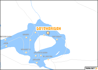
Nearby towns ::
((Saryāfah)) (1.6km west) //
((Tartāsah)) (3.1km south east) //
((Shāhimah)) (4.4km west) //
((Jarnah)) (6.2km west) //
((Jazīrat Sūsah)) (8.3km south) //
((Sawārī)) (7.2km west) //
((Suwaynākh)) (9.0km south west) //
((Hadharta)) (9.8km south west) //
[all distances 'as the bird flies' and approximate] 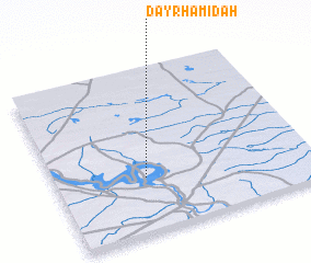 Places with similar names to ((Dayr Ḩamīdah)), Iraq ::
// Douar Hammadi (MA)
// Dār Ḩamādī (IQ)
// Dawwār Ḩamad (EG)
// Dawwār Ḩammādah (TN)
// Douar Hamouda (TN)
// Dario Ahumada (MX)
// Dār Ḩammād (SD)
// Ţayyār Ḩamādah (SY)
// Dar Hamida (MA)
// Douar Hamada (MA)
Disclaimer :: Information on this page comes without warranty of any kind |
||
|
Where is ((Dayr Ḩamīdah))? Elevation and coordinates ::
Latitude (lat): 34°20'0"N Longitude (lon): 42°21'0"E
Elevation (approx.): 138m (map arrows pan, magnifying glasses zoom) |
||
|
Visiting ((Dayr Ḩamīdah))? Hotel/Accommodation ::
Book a hotel in ((Dayr Ḩamīdah)) Travel Guide ::
Buy a travel guide for Iraq rental cars ::
car rental offers GPS waypoint ::
download a GPX waypoint (PoI) of ((Dayr Ḩamīdah)) for your GPS receiver
|
||