|
search place name
|
||
Guellid (Tétouan, Morocco)Guellid is a town in the Tétouan region of Morocco. An overview map of the region around Guellid is displayed below.
regional and 3d topo map of Guellid, Morocco ::

Guellid airports ::
The nearest airport is TTU - Tetouan Saniat Rmel, located 25.7 km east of Guellid.
Other airports nearby include TNG - Tanger Ibn Batouta (30.5 km west), GIB - Gibraltar (61.7 km north), XRY - Jerez (130.1 km north), AGP - Malaga (152.2 km north east), Nearby towns ::
El Mekhaled (1.4km west) //
Er Remel (1.5km east) //
Sgaloua (1.5km east) //
Remel (1.9km north) //
Fechkara (2.2km south) //
Merj el Lououa (2.6km north) //
Khandak el Kebch (2.9km south west) //
Harrif (3.7km south) //
El Mejibka (3.0km west) //
Aonzar (4.0km south) //
Mengrala (4.4km north east) //
Aïn elAlak (5.0km south) //
Tarech (4.8km south east) //
Azib Aïn el Alak (5.3km south) //
Hansis (4.5km east) //
Amersane (4.7km south east) //
Dar Touilech (5.8km north) //
Aïn Boustza (5.8km north) //
Oued ez Zeïtoun (5.1km north west) //
Gharifa (5.6km north west) //
Ghedir el Haj (6.2km south) //
Siouana (5.6km north east) //
Ouazla (6.4km north west) //
Abd el Liouech (5.8km south east) //
Fandak el Aïn ej Jdida (7.4km south) //
Sadies (6.3km east) //
Daja (6.3km west) //
Zemmij (7.6km north) //
Ed Daya (6.4km west) //
[all distances 'as the bird flies' and approximate] 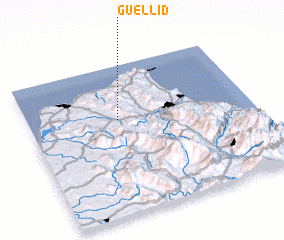 Places with similar names to Guellid, Morocco ::
Disclaimer :: Information on this page comes without warranty of any kind |
||
|
Where is Guellid? Elevation and coordinates ::
Latitude (lat): 35°38'0"N Longitude (lon): 5°36'0"W
Elevation (approx.): 477m (map arrows pan, magnifying glasses zoom) |
||
|
Visiting Guellid? Hotel/Accommodation ::
Book a hotel in Guellid Travel Guide ::
Buy a travel guide for Morocco rental cars ::
car rental offers GPS waypoint ::
download a GPX waypoint (PoI) of Guellid for your GPS receiver
|
||