|
search place name
|
||
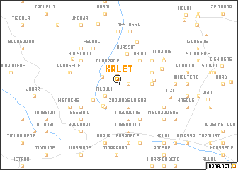
Kalet (Al Hoceïma, Morocco)Kalet is a town in the Al Hoceïma region of Morocco. An overview map of the region around Kalet is displayed below.
regional and 3d topo map of Kalet, Morocco ::
Kalet airports ::
The nearest airport is AHU - Al Hociema Cherif El Idrissi, located 56.2 km east of Kalet.
Other airports nearby include TTU - Tetouan Saniat Rmel (102.2 km north west), FEZ - Fez Saiss (132.5 km south), MLN - Melilla (137.1 km east), GIB - Gibraltar (149.6 km north west), Nearby towns ::
Ichaouiene (1.2km east) //
Azghar (1.8km north) //
Aerem (2.0km north) //
Tilouli (2.5km south west) //
Aghanza (2.5km north west) //
Ouahrane (3.0km north west) //
Zaouia del Misab (3.8km south) //
Douirem (3.8km south) //
Aït Yahia (3.9km south west) //
Amezoug (4.0km south west) //
Boujebbar (4.1km south west) //
Ouassîf (5.0km north) //
Tabjij (4.7km north east) //
Timouya (4.3km east) //
Boumileh (4.7km north east) //
Ibarhonene (4.7km north east) //
Ibrânene (4.6km east) //
Taguiouine (5.5km south) //
Imechahoudene (6.1km south east) //
Tafrast (5.7km north east) //
Oulad Abdallah (6.0km south west) //
Feddal (6.6km north west) //
Bouscout (6.2km north west) //
Beni Guemil (6.0km north east) //
Anzagh (7.1km north) //
Taberrant (7.4km south) //
Igueniouene (6.8km south east) //
Sessaad (7.3km south west) //
Bogafar (7.3km south west) //
[all distances 'as the bird flies' and approximate] 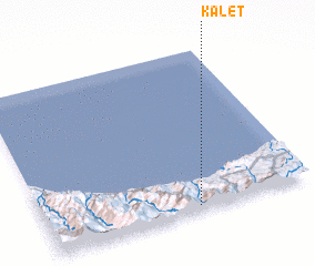 Places with similar names to Kalet, Morocco ::
Disclaimer :: Information on this page comes without warranty of any kind |
||
|
Where is Kalet? Elevation and coordinates ::
Latitude (lat): 35°1'55"N Longitude (lon): 4°25'48"W
Elevation (approx.): 1002m (map arrows pan, magnifying glasses zoom) |
||
|
Visiting Kalet? Hotel/Accommodation ::
Book a hotel in Kalet Travel Guide ::
Buy a travel guide for Morocco rental cars ::
car rental offers GPS waypoint ::
download a GPX waypoint (PoI) of Kalet for your GPS receiver
|
||