|
search place name
|
||
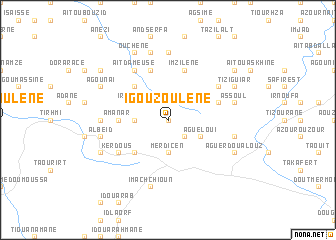
Igouzoulene (Tiznit, Morocco)Igouzoulene is a town in the Tiznit region of Morocco. An overview map of the region around Igouzoulene is displayed below.
regional and 3d topo map of Igouzoulene, Morocco ::
Igouzoulene airports ::
The nearest airport is AGA - Agadir Inezgane, located 91.6 km north of Igouzoulene.
Other airports nearby include TTA - Tan Tan Plage Blanche (220.7 km south west), TIN - Tindouf (236.3 km south east), Nearby towns ::
Targuinine (0.0km north) //
Id Darne (0.0km north) //
Is Koula (2.5km south east) //
Amkraz (2.5km north east) //
Ibanane (3.2km west) //
Id Ali Ou Saïd (3.7km south) //
Merdicen (3.7km south) //
Agueloui (3.7km south east) //
Irhalene (3.7km north west) //
Id Raïs (4.9km south west) //
Ouchene nʼTlilis (4.9km north west) //
Amanar (4.8km west) //
Imzilene (5.8km north) //
Igoujjimene (5.8km north) //
Aït Chouiaz (5.2km east) //
Tizgui (6.1km south west) //
Kerdous (6.1km south west) //
Aït Dameuse (6.4km north west) //
Imezgane (6.1km north east) //
Imi nʼ Tagant (7.4km north) //
Aït Tinrmitine (6.4km west) //
Imachchioun (7.6km south) //
Albeïd (6.7km west) //
Timliline (6.7km east) //
Tiroula (7.6km north) //
Assoul (6.7km east) //
Ouchene (8.1km north west) //
Sidi Lhassene (7.4km south west) //
Aït Hassane (8.1km north west) //
[all distances 'as the bird flies' and approximate]  Places with similar names to Igouzoulene, Morocco ::
// Igousouln (MA)
// Igouzoulene (MA)
// Igouzouln (MA)
// Igouzouln (MA)
// Iguesalene (MA)
// Iksilene (DZ)
Disclaimer :: Information on this page comes without warranty of any kind |
||
|
Where is Igouzoulene? Elevation and coordinates ::
Latitude (lat): 29°35'0"N Longitude (lon): 9°18'0"W
Elevation (approx.): 1235m (map arrows pan, magnifying glasses zoom) |
||
|
Visiting Igouzoulene? Hotel/Accommodation ::
Book a hotel in Igouzoulene Travel Guide ::
Buy a travel guide for Morocco rental cars ::
car rental offers GPS waypoint ::
download a GPX waypoint (PoI) of Igouzoulene for your GPS receiver
|
||