|
search place name
|
||
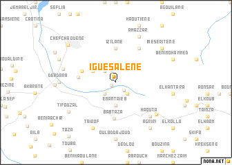
Iguesalene (Chaouen, Morocco)Iguesalene is a town in the Chaouen region of Morocco. An overview map of the region around Iguesalene is displayed below.
regional and 3d topo map of Iguesalene, Morocco ::
Iguesalene airports ::
The nearest airport is TTU - Tetouan Saniat Rmel, located 54.1 km north of Iguesalene.
Other airports nearby include TNG - Tanger Ibn Batouta (93.9 km north west), GIB - Gibraltar (115.6 km north), AHU - Al Hociema Cherif El Idrissi (124.2 km east), FEZ - Fez Saiss (133.5 km south), Nearby towns ::
Zaouiet el Habteyine (0.7km south west) //
Majjo (1.7km south east) //
Tissouka (1.8km north) //
Fokaïene (2.4km north west) //
Ikelaïene (2.4km south east) //
Ouest (2.4km south west) //
Emantaïeb (3.7km south) //
Arrasene (3.6km north west) //
Izilane (5.6km north) //
Armaouta (4.9km west) //
Bab Taza (5.9km south) //
Amejri (5.0km west) //
Oulad el Haj (6.3km north east) //
Haouta (7.2km south east) //
Amazzar (8.0km north) //
Taourirt (8.0km north) //
Tairof (8.0km south) //
Haikiouene (8.0km south) //
Bouhalla (7.4km south east) //
Aïn er Rami (7.3km west) //
Tifouzal (7.9km south west) //
Imeseritene (8.2km north east) //
Asereh (8.7km south east) //
Agriri (8.7km south east) //
Chefchaouene (8.8km north west) //
Taza (10.8km south west) //
[all distances 'as the bird flies' and approximate] 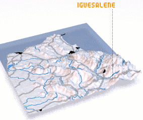 Places with similar names to Iguesalene, Morocco ::
// Igousouln (MA)
// Igouzoulene (MA)
// Igouzoulene (MA)
// Igouzouln (MA)
// Igouzouln (MA)
// Iksilene (DZ)
Disclaimer :: Information on this page comes without warranty of any kind |
||
|
Where is Iguesalene? Elevation and coordinates ::
Latitude (lat): 35°7'0"N Longitude (lon): 5°12'0"W
Elevation (approx.): 799m (map arrows pan, magnifying glasses zoom) |
||
|
Visiting Iguesalene? Hotel/Accommodation ::
Book a hotel in Iguesalene Travel Guide ::
Buy a travel guide for Morocco rental cars ::
car rental offers GPS waypoint ::
download a GPX waypoint (PoI) of Iguesalene for your GPS receiver
|
||