|
search place name
|
||
Sbiti (Marrakech, Morocco)Sbiti is a town in the Marrakech region of Morocco. An overview map of the region around Sbiti is displayed below.
regional and 3d topo map of Sbiti, Morocco ::

Sbiti airports ::
The nearest airport is RAK - Marrakech Menara, located 31.4 km north west of Sbiti.
Other airports nearby include OZZ - Ouarzazate (100.9 km south east), AGA - Agadir Inezgane (197.9 km south west), CMN - Casablanca Mohammed V Intl (221.2 km north), Nearby towns ::
Aguelmous (1.6km west) //
Maout (2.4km north west) //
Amekhlij (2.7km south west) //
Timeskrine (3.2km east) //
Igzi Ou Fella (4.0km south east) //
El Kriet (3.7km north east) //
Agadir nʼTafent (4.0km south west) //
NʼChaba (4.0km north west) //
Tiguemmi n Oumzil et Tnine (4.5km east) //
El Jemʼa Ghemat (4.9km north east) //
Sidi Bou Yahia (4.9km north west) //
El Briza (5.6km north) //
Aït Zat (5.6km north) //
Aït Ou Bohou (5.3km north east) //
Kherouagh (5.1km west) //
Ouaguejdit (5.8km south) //
Akhlij (5.6km east) //
Tafza (6.0km south east) //
Souk Tedrara (6.0km south west) //
Akkara (7.4km north) //
Azrou Melloul (6.6km east) //
Dou Ghemat (7.6km north) //
Aït Salam (6.6km west) //
Tleta (7.3km south west) //
El Hajeb nʼAït Ouadouz (7.3km north east) //
Bou Haddou (7.3km north east) //
Allous (8.1km south west) //
Aït Namous (8.1km north east) //
Aït Ali Ou Allah (8.4km north east) //
[all distances 'as the bird flies' and approximate] 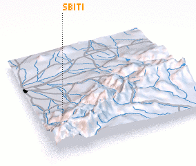 Places with similar names to Sbiti, Morocco ::
Disclaimer :: Information on this page comes without warranty of any kind |
||
|
Where is Sbiti? Elevation and coordinates ::
Latitude (lat): 31°23'0"N Longitude (lon): 7°50'0"W
Elevation (approx.): 816m (map arrows pan, magnifying glasses zoom) |
||
|
Visiting Sbiti? Hotel/Accommodation ::
Book a hotel in Sbiti Travel Guide ::
Buy a travel guide for Morocco rental cars ::
car rental offers GPS waypoint ::
download a GPX waypoint (PoI) of Sbiti for your GPS receiver
|
||