|
search place name
|
||
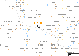
Timlilt (Taroudannt, Morocco)Timlilt is a town in the Taroudannt region of Morocco. An overview map of the region around Timlilt is displayed below.
regional and 3d topo map of Timlilt, Morocco ::
Timlilt airports ::
The nearest airport is OZZ - Ouarzazate, located 108.6 km north east of Timlilt.
Other airports nearby include RAK - Marrakech Menara (117.5 km north), AGA - Agadir Inezgane (154.4 km west), Nearby towns ::
Zaouia Taguergoust (2.4km south east) //
Tagadirt (3.7km south west) //
Taliouine (3.7km south east) //
Bou Oulgou (4.9km north west) //
Taguenza (4.8km west) //
Talemt (5.6km north) //
Issougane (5.6km north) //
Tarhzout (5.1km west) //
Ed Douzrou (5.1km east) //
Bou Izdadene (6.4km north west) //
Assoul (6.1km south east) //
Assougoum (6.1km south east) //
Timguilt (7.4km south) //
Taourirt nʼ Aït Lahsene (6.4km east) //
Amane Oulli (7.6km north) //
Irhil nʼ Imechtaguil (6.6km east) //
Agouni nʼ Ouderdour (7.3km north east) //
Talmentoukht (7.3km north east) //
Aït Abbou (8.1km south east) //
Doutourirt (8.3km south west) //
Imzil (8.8km south west) //
Tadkout (8.8km south east) //
Toufassour (8.5km north west) //
Tazzarine (9.8km north west) //
Ammaïn (10.2km south west) //
[all distances 'as the bird flies' and approximate]  Places with similar names to Timlilt, Morocco ::
// Tamelelt (MA)
// Tamellalt (MA)
// Tamellalt (MA)
// Tamlelt (MA)
// Timelilt (MA)
// Tombalilatu (ID)
// Tombulilata (ID)
// Tombulilato (ID)
// Tamalaoulaout (NE)
// Tamelalt (MA)
Disclaimer :: Information on this page comes without warranty of any kind |
||
|
Where is Timlilt? Elevation and coordinates ::
Latitude (lat): 30°33'0"N Longitude (lon): 7°57'0"W
Elevation (approx.): 1023m (map arrows pan, magnifying glasses zoom) |
||
|
Visiting Timlilt? Hotel/Accommodation ::
Book a hotel in Timlilt Travel Guide ::
Buy a travel guide for Morocco rental cars ::
car rental offers GPS waypoint ::
download a GPX waypoint (PoI) of Timlilt for your GPS receiver
|
||