|
search place name
|
||
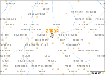
Znada (Marrakech, Morocco)Znada is a town in the Marrakech region of Morocco. An overview map of the region around Znada is displayed below.
regional and 3d topo map of Znada, Morocco ::
Znada airports ::
The nearest airport is RAK - Marrakech Menara, located 74.5 km north east of Znada.
Other airports nearby include AGA - Agadir Inezgane (125.8 km south west), OZZ - Ouarzazate (174.3 km east), Nearby towns ::
Aït Ou Guera (1.9km south) //
Irig (1.6km east) //
Oulgues (1.6km west) //
El Faïda (2.4km north west) //
Dar Bou Neddi (2.4km south west) //
Seddert Lalla Aziza (2.4km north west) //
Tigoudar (3.2km west) //
Agafaï (3.2km west) //
Algo (3.7km south east) //
Arzioum (3.7km north east) //
Tarroumt (3.7km north east) //
Tasdimt (4.0km north east) //
Oulad Aïssa (4.0km north east) //
Azerouane (3.7km north west) //
Taguentane (3.7km south west) //
Zaouia Sidi Rehal (4.8km east) //
Borj Agharghar (4.8km east) //
Bouzedouk (5.1km west) //
Aït Alizine el Mellah (6.0km south west) //
Agouni (6.4km south east) //
Kattos (6.4km south east) //
Tigmi Jdid (6.3km west) //
Tless (7.6km south) //
Agadir Irigdalene (6.6km west) //
Arba des Douirane (6.6km west) //
Toukhribine (7.3km south east) //
Dar Lakhalta (7.3km north west) //
Izgri (8.8km south east) //
Sahed el Atrous (8.8km north west) //
[all distances 'as the bird flies' and approximate]  Places with similar names to Znada, Morocco ::
Disclaimer :: Information on this page comes without warranty of any kind |
||
|
Where is Znada? Elevation and coordinates ::
Latitude (lat): 31°15'0"N Longitude (lon): 8°42'0"W
Elevation (approx.): 711m (map arrows pan, magnifying glasses zoom) |
||
|
Visiting Znada? Hotel/Accommodation ::
Book a hotel in Znada Travel Guide ::
Buy a travel guide for Morocco rental cars ::
car rental offers GPS waypoint ::
download a GPX waypoint (PoI) of Znada for your GPS receiver
|
||