|
search place name
|
||
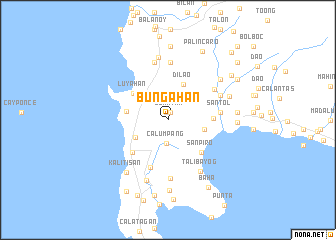
Bungahan (Batangas, Philippines)Bungahan is a town in the Batangas region of Philippines. An overview map of the region around Bungahan is displayed below.
regional and 3d topo map of Bungahan, Philippines ::
Bungahan airports ::
The nearest airport is MNL - Manila Ninoy Aquino Intl, located 73.5 km north east of Bungahan.
Nearby towns ::
Duhatan (0.9km north) //
Calumpang (2.6km south) //
Lagnas (3.4km north east) //
Binubusan (3.5km north west) //
Balibago (4.0km south west) //
Dalig (4.1km east) //
Dilao (4.3km north) //
Matabungkay (4.6km west) //
Luyahan (4.8km north west) //
Canda (4.9km east) //
San Piro (5.2km south east) //
Talisay (5.3km south west) //
Biga (5.6km south) //
Santol (5.8km east) //
Malibu (6.1km north east) //
Pinagcurusan (6.4km north) //
Calaocan (6.3km north east) //
Magabe (6.3km north east) //
Cruz (6.6km north) //
Sambuñgan (6.6km south) //
Talibayog (6.8km south east) //
Calumpit (7.1km north) //
Lucsuhin (7.2km south) //
Muntingtubig (7.2km east) //
Bolboc (7.3km north east) //
Kalitisan (7.4km south west) //
Balayan (7.5km east) //
Lanatan (7.5km east) //
Calzada (7.5km east) //
[all distances 'as the bird flies' and approximate] 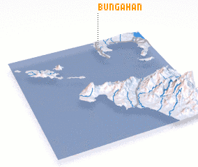 Places with similar names to Bungahan, Philippines ::
Disclaimer :: Information on this page comes without warranty of any kind |
||
|
Where is Bungahan? Elevation and coordinates ::
Latitude (lat): 13°56'33"N Longitude (lon): 120°39'50"E
Elevation (approx.): 59m (map arrows pan, magnifying glasses zoom) |
||
|
Visiting Bungahan? Hotel/Accommodation ::
Book a hotel in Bungahan Travel Guide ::
Buy a travel guide for Philippines rental cars ::
car rental offers GPS waypoint ::
download a GPX waypoint (PoI) of Bungahan for your GPS receiver
|
||