|
search place name
|
||
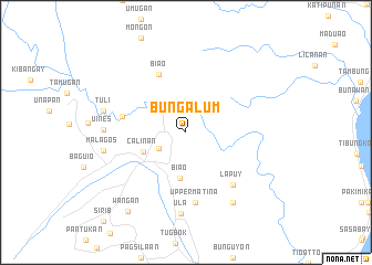
Bungalum (Davao, Philippines)Bungalum is a town in the Davao region of Philippines. An overview map of the region around Bungalum is displayed below.
regional and 3d topo map of Bungalum, Philippines ::
Bungalum airports ::
The nearest airport is CEB - Cebu Cotabato, located 141.6 km west of Bungalum.
Other airports nearby include CGY - Ladag Cagayan De Oro (164.5 km north west), Nearby towns ::
Culanan (3.1km south west) //
Biao (4.7km south) //
Calinan (4.7km south west) //
Biao (6.4km north west) //
Lacson (6.6km west) //
Lapuy (7.0km south east) //
Upper Matina (7.2km south) //
Ula (8.2km south) //
Uines (8.2km west) //
Guianga (8.5km south east) //
Tuli (8.5km west) //
Malagos (8.5km west) //
Wañgan (9.8km south west) //
[all distances 'as the bird flies' and approximate]  Places with similar names to Bungalum, Philippines ::
// Ban Kalum (TH)
// Ban Kiu Lom (TH)
// Ban Klam (TH)
// Ban Ko Loi Mai (TH)
// Ban Na Khlom (TH)
// Ban Ngu Luam (TH)
// Bangloma (CD)
// Bena-Kalombo (CD)
// Bena-Kalombo (CD)
// Bungalama (CD)
Disclaimer :: Information on this page comes without warranty of any kind |
||
|
Where is Bungalum? Elevation and coordinates ::
Latitude (lat): 7°12'51"N Longitude (lon): 125°29'28"E
Elevation (approx.): 189m (map arrows pan, magnifying glasses zoom) |
||
|
Visiting Bungalum? Hotel/Accommodation ::
Book a hotel in Bungalum Travel Guide ::
Buy a travel guide for Philippines rental cars ::
car rental offers GPS waypoint ::
download a GPX waypoint (PoI) of Bungalum for your GPS receiver
|
||