|
search place name
|
||
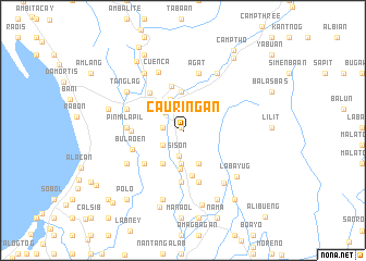
Cauriñgan (Pangasinan, Philippines)Cauriñgan is a town in the Pangasinan region of Philippines. An overview map of the region around Cauriñgan is displayed below.
regional and 3d topo map of Cauriñgan, Philippines ::
Cauriñgan airports ::
The nearest airport is BAG - Baguio, located 22.5 km north east of Cauriñgan.
Other airports nearby include MNL - Manila Ninoy Aquino Intl (194.4 km south), Nearby towns ::
Artacho (0.4km north west) //
Sagunto (0.4km north west) //
Cabaruan (2.0km west) //
Cabaritan (2.5km south west) //
Sison (2.6km south) //
Esperanza (2.6km north west) //
Subusub (2.9km north west) //
Asan Norte (3.4km south) //
Samuyao (3.4km south) //
Udiao (3.4km north west) //
Camp One (3.4km north) //
Paldit (3.7km south east) //
Alava (4.0km south) //
Quil-lo (3.9km south west) //
Amagbagan (3.9km south west) //
Inmalog (3.9km south west) //
San Fabian (3.9km south west) //
Dongon (4.0km north) //
Saytan (4.7km north) //
Bataquil (4.8km south) //
Rosario (5.0km north west) //
Sison (5.1km south west) //
Kabuanan (5.1km south west) //
Bimmeckeg (5.0km west) //
Asan Sur (5.3km south) //
Bobonan (5.3km south) //
Paldit (5.5km south) //
Bulaoen (5.3km west) //
Pinmilapil (5.6km west) //
[all distances 'as the bird flies' and approximate]  Places with similar names to Cauriñgan, Philippines ::
// Carangan (PH)
// Carangan (PH)
// Carangan (PH)
// Caranguian (PH)
// Carañugan (PH)
// Carinogan (PH)
// Carnigan (US)
// Crîngu Nou (RO)
// Grankina (RU)
// Grankino (RU)
Disclaimer :: Information on this page comes without warranty of any kind |
||
|
Where is Cauriñgan? Elevation and coordinates ::
Latitude (lat): 16°11'50"N Longitude (lon): 120°31'7"E
Elevation (approx.): 145m (map arrows pan, magnifying glasses zoom) |
||
|
Visiting Cauriñgan? Hotel/Accommodation ::
Book a hotel in Cauriñgan Travel Guide ::
Buy a travel guide for Philippines rental cars ::
car rental offers GPS waypoint ::
download a GPX waypoint (PoI) of Cauriñgan for your GPS receiver
|
||