|
search place name
|
||
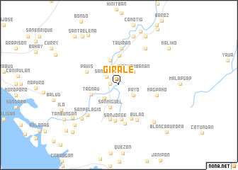
Girale (Samar, Philippines)Girale is a town in the Samar region of Philippines. An overview map of the region around Girale is displayed below.
regional and 3d topo map of Girale, Philippines ::
Girale airports ::
The nearest airport is TAC - Tacloban Daniel Z Romualdez, located 91.5 km south of Girale.
Other airports nearby include NOP - Masbate Mactan Cebu Intl (212.1 km south west), BCD - Bacolod (258.1 km south west), Nearby towns ::
Caugbusan (1.4km west) //
Rauis (1.4km west) //
San Agustin (1.4km west) //
Santo Niño (2.3km north west) //
Payo (2.8km south east) //
Pizarro (2.9km north) //
Kinamambanan (3.0km north east) //
Gandara (3.0km south west) //
San Miguel (3.8km south) //
Jazmines (4.1km north) //
Tagnau (4.5km west) //
Pinaplata (4.6km north) //
La Paz (5.4km south) //
Pawis (5.4km west) //
Erenas (5.6km south) //
Obrero (5.6km south) //
San Jorge (5.7km south) //
Tauiran (5.8km north) //
Sapinit (6.2km south) //
Magpaho (6.1km east) //
Bulao (6.2km south east) //
San Pelagio (6.8km south west) //
San Jose de Panaugan (7.0km north east) //
Elcano (7.9km north) //
Bu-ao (7.9km north) //
Buenos Aires (7.9km south west) //
Buenavista (8.0km south east) //
De-it (8.6km north east) //
Concepcion (8.8km south west) //
[all distances 'as the bird flies' and approximate]  Places with similar names to Girale, Philippines ::
Disclaimer :: Information on this page comes without warranty of any kind |
||
|
Where is Girale? Elevation and coordinates ::
Latitude (lat): 12°1'54"N Longitude (lon): 124°49'46"E
Elevation (approx.): 24m (map arrows pan, magnifying glasses zoom) |
||
|
Visiting Girale? Hotel/Accommodation ::
Book a hotel in Girale Travel Guide ::
Buy a travel guide for Philippines rental cars ::
car rental offers GPS waypoint ::
download a GPX waypoint (PoI) of Girale for your GPS receiver
|
||