|
search place name
|
||
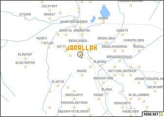
Jār Allāh (Dhī Qār, Iraq)Jār Allāh is a town in the Dhī Qār region of Iraq. An overview map of the region around Jār Allāh is displayed below.
regional and 3d topo map of Jār Allāh, Iraq ::
Jār Allāh airports ::
The nearest airport is BSR - Basrah Intl, located 177.9 km south east of Jār Allāh.
Nearby towns ::
Mashkūr (1.9km north) //
Mūsá al Majīd (1.6km east) //
Ālbū Hilālah (2.4km north east) //
Sayyid Ghannām (2.4km south east) //
‘Abd aş Şāḩib Hulayyil (2.4km west) //
‘Abd al Wāḩid (3.3km north) //
‘Ammār (3.7km south) //
Sayyid Riḑā (3.7km north west) //
Al Bid‘ah (3.9km south east) //
Hawāwīyah (5.6km north) //
Muhaydī (6.4km north west) //
Sa‘īd al ‘Abīd (6.0km north east) //
An Naşr (7.1km north) //
Su‘ūd as Salmān (7.1km south west) //
Ash Shaţrah (6.9km south east) //
Suwayq aş Şuqbān (7.6km north) //
Ḩusayn (7.6km south) //
‘Abd al Muḩammad (6.6km east) //
Sayyid al Jalīl (6.6km east) //
Jubayn (7.3km north west) //
‘Aylān (7.1km west) //
Farḩān ar Rodham (7.3km south east) //
Āl Ḩātim (7.8km south west) //
Bandar as Sa‘dūn (7.3km east) //
Ḩasan (9.3km north east) //
Al Ḩāwī (9.4km south east) //
Ālbū Kāmil (9.7km south west) //
[all distances 'as the bird flies' and approximate]  Places with similar names to Jār Allāh, Iraq ::
Disclaimer :: Information on this page comes without warranty of any kind |
||
|
Where is Jār Allāh? Elevation and coordinates ::
Latitude (lat): 31°28'0"N Longitude (lon): 46°8'0"E
Elevation (approx.): 5m (map arrows pan, magnifying glasses zoom) |
||
|
Visiting Jār Allāh? Hotel/Accommodation ::
Book a hotel in Jār Allāh Travel Guide ::
Buy a travel guide for Iraq rental cars ::
car rental offers GPS waypoint ::
download a GPX waypoint (PoI) of Jār Allāh for your GPS receiver
|
||