|
search place name
|
||
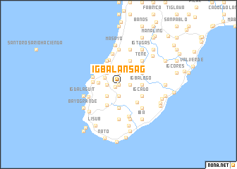
Igbalansag (Antique, Philippines)Igbalansag is a town in the Antique region of Philippines. An overview map of the region around Igbalansag is displayed below.
regional and 3d topo map of Igbalansag, Philippines ::
Igbalansag airports ::
The nearest airport is SJI - San Jose Antique, located 29.7 km north of Igbalansag.
Other airports nearby include ILO - Iloilo (67.6 km east), BCD - Bacolod (106.6 km east), KLO - Kalibo (137.9 km north), DGT - Dumaguete (195.0 km south east), Nearby towns ::
Ouanan (0.0km north) //
Bucaobucao (0.0km north) //
Abaca (0.7km south west) //
Barasanan (1.0km north west) //
Nasuli (1.8km east) //
Igcasiad (1.8km east) //
Danauan (1.9km south) //
Opsan (1.9km north) //
Gaman (1.9km south) //
Idamacio (1.8km west) //
Igcadac (1.8km west) //
Butuan (1.8km west) //
Bagumbayan (1.8km west) //
Igdorarog (1.8km west) //
Camandagan (1.8km west) //
Dao (2.4km north west) //
Ysulat (2.6km north west) //
Igbancal (2.6km south west) //
Cato-ogan (3.1km west) //
Igbalogo (3.6km east) //
Ginarogan (3.7km south) //
Tagaytay (3.8km south west) //
Pacencia (4.0km west) //
Nasuli (4.1km south east) //
Igcabuad (4.1km north east) //
Igcado (4.1km south east) //
Igcalauagan (4.1km north east) //
Balud (4.1km north west) //
Atabay (4.2km north) //
[all distances 'as the bird flies' and approximate] 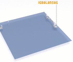 Places with similar names to Igbalansag, Philippines :: Disclaimer :: Information on this page comes without warranty of any kind |
||
|
Where is Igbalansag? Elevation and coordinates ::
Latitude (lat): 10°30'0"N Longitude (lon): 121°58'0"E
Elevation (approx.): 70m (map arrows pan, magnifying glasses zoom) |
||
|
Visiting Igbalansag? Hotel/Accommodation ::
Book a hotel in Igbalansag Travel Guide ::
Buy a travel guide for Philippines rental cars ::
car rental offers GPS waypoint ::
download a GPX waypoint (PoI) of Igbalansag for your GPS receiver
|
||