|
search place name
|
||
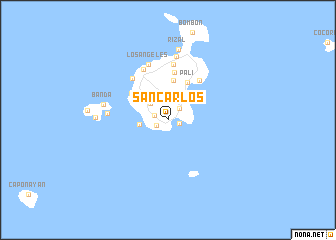
San Carlos (Palawan, Philippines)San Carlos is a town in the Palawan region of Philippines. An overview map of the region around San Carlos is displayed below.
regional and 3d topo map of San Carlos, Philippines ::
San Carlos airports ::
The nearest airport is SJI - San Jose Antique, located 97.4 km east of San Carlos.
Other airports nearby include ILO - Iloilo (164.5 km east), KLO - Kalibo (174.3 km north east), BCD - Bacolod (207.1 km east), Nearby towns ::
Paua (1.3km south west) //
Maning (1.4km east) //
Balading (1.5km west) //
Balaguen (1.8km north east) //
Paua (2.6km north west) //
Baayad (3.1km west) //
Ingabas (4.4km north) //
Pali (4.7km north east) //
Suba (5.0km north west) //
Buscan (5.4km north) //
Lucbuan (5.7km north east) //
Cuyo (6.1km north west) //
Maringian (6.2km north west) //
Baoaran (6.3km north) //
Los Angeles (6.5km north) //
Isla de Sur (6.7km west) //
Magsaysay (7.1km north) //
Banda (7.3km west) //
Rizal (8.0km north) //
Bisucay (7.9km west) //
[all distances 'as the bird flies' and approximate] 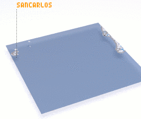 Places with similar names to San Carlos, Philippines ::
// San Carlos (US)
// San Carlos (US)
// San Carlos (US)
// San Carlos (PA)
// San Carlos (PA)
// Singréllos (GR)
// Cinco Reales (CU)
// San Carlos (CU)
// San Carlos (CU)
// San Carlos (CU)
Disclaimer :: Information on this page comes without warranty of any kind |
||
|
Where is San Carlos? Elevation and coordinates ::
Latitude (lat): 10°48'38"N Longitude (lon): 121°2'39"E
Elevation (approx.): -4m (map arrows pan, magnifying glasses zoom) |
||
|
Visiting San Carlos? Hotel/Accommodation ::
Book a hotel in San Carlos Travel Guide ::
Buy a travel guide for Philippines rental cars ::
car rental offers GPS waypoint ::
download a GPX waypoint (PoI) of San Carlos for your GPS receiver
|
||