|
search place name
|
||
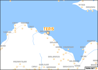
Teris (Sorsogon, Philippines)Teris is a town in the Sorsogon region of Philippines. An overview map of the region around Teris is displayed below.
regional and 3d topo map of Teris, Philippines ::
Teris airports ::
The nearest airport is KLO - Kalibo, located 235.0 km south west of Teris.
Other airports nearby include TAC - Tacloban Daniel Z Romualdez (236.3 km south east), Nearby towns ::
Osiao (1.3km south west) //
Santo Niño (1.6km west) //
Cibulan (2.6km south east) //
Libanon (4.1km south east) //
San Juan (4.1km south east) //
Punte de Jesus (5.0km west) //
Himaog (6.6km south east) //
Cavit (7.0km west) //
Santa Cruz (7.3km south east) //
Bogna-Caricaran (9.2km south east) //
Del Rosario (9.2km south east) //
San Luis (9.2km south east) //
Santo Domingo (9.2km south east) //
Cabarbohan (9.1km south east) //
Cagpandan (9.1km south east) //
Bacon (9.3km south east) //
[all distances 'as the bird flies' and approximate]  Places with similar names to Teris, Philippines ::
// Douar ez Zaouia (MA)
// Douar Zaouia (MA)
// Tarasa (RU)
// Tarasy (RU)
// Tarasy (RU)
// Tarusa (RU)
// Tarusy (RU)
// Terasy (RU)
// Torres (BO)
// Torrez (BO)
Disclaimer :: Information on this page comes without warranty of any kind |
||
|
Where is Teris? Elevation and coordinates ::
Latitude (lat): 13°6'0"N Longitude (lon): 123°59'0"E
Elevation (approx.): -32768m (map arrows pan, magnifying glasses zoom) |
||
|
Visiting Teris? Hotel/Accommodation ::
Book a hotel in Teris Travel Guide ::
Buy a travel guide for Philippines rental cars ::
car rental offers GPS waypoint ::
download a GPX waypoint (PoI) of Teris for your GPS receiver
|
||