|
search place name
|
||
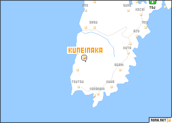
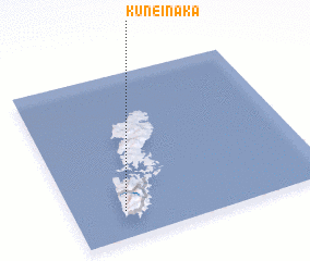
Kune-inaka (Nagasaki, Japan)Kune-inaka is a town in the Nagasaki region of Japan. An overview map of the region around Kune-inaka is displayed below.
regional and 3d topo map of Kune-inaka, Japan ::
Kune-inaka airports ::
The nearest airport is TSJ - Tsushima, located 17.8 km north east of Kune-inaka.
Other airports nearby include IKI - Iki (71.2 km south east), PUS - Kimhae Gimhae Intl (114.9 km north), FUK - Fukuoka (132.4 km south east), NGS - Nagasaki (153.6 km south east), Nearby towns ::
 Places with similar names to Kune-inaka, Japan ::
Disclaimer :: Information on this page comes without warranty of any kind |
||
|
Where is Kune-inaka? Elevation and coordinates ::
Latitude (lat): 34°10'0"N Longitude (lon): 129°12'0"E
Elevation (approx.): 171m (map arrows pan, magnifying glasses zoom) |
||
|
Visiting Kune-inaka? Hotel/Accommodation ::
Book a hotel in Kune-inaka Travel Guide ::
Buy a travel guide for Japan rental cars ::
car rental offers GPS waypoint ::
download a GPX waypoint (PoI) of Kune-inaka for your GPS receiver
|
||