|
search place name
|
||
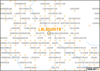
La Lagunita (Peravia, Dominican Republic)La Lagunita is a town in the Peravia region of Dominican Republic. An overview map of the region around La Lagunita is displayed below.
regional and 3d topo map of La Lagunita, Dominican Republic ::
La Lagunita airports ::
The nearest airport is SDQ - Santo Domingo Las Americas Intl, located 78.7 km east of La Lagunita.
Other airports nearby include BRX - Barahona Maria Montez Intl (83.7 km south west), STI - Santiago Cibao Intl (95.4 km north), POP - Puerto Plata Gregorio Luperon Intl (133.1 km north), LRM - La Romana Casa De Campo Intl (157.7 km east), Nearby towns ::
El Garrote (0.0km north) //
Paso Hondo (0.0km north) //
La Atravesía (0.0km north) //
El Loasa (1.9km north) //
El Jobo (1.9km north) //
El Chifle (1.9km north) //
Pino Mocho (1.9km north) //
Los Arroyos (1.8km west) //
El Capá (1.9km south) //
La Paloma (1.9km south) //
Los Indios (1.9km south) //
Pío (1.9km south) //
Trapiche (1.8km east) //
El Mogote (1.8km east) //
El Derrico (1.8km east) //
Las Barías (1.8km east) //
Río Abajo (2.6km north west) //
La Boca de Cazuela (2.6km north west) //
Boca del Caño (2.6km north west) //
Mellizo (2.6km north west) //
Los Dajaos (2.6km north east) //
El Rosalito (2.6km north east) //
Santana (2.6km south west) //
La Laguna (2.6km south west) //
Boca de Mahoma (2.6km south east) //
La Cuchilla de Pío (2.6km south east) //
Palo de Caja (2.6km south east) //
Valentín (3.5km west) //
Pelegrino (3.5km west) //
[all distances 'as the bird flies' and approximate] 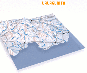 Places with similar names to La Lagunita, Dominican Republic ::
// Lilkendey (DE)
// La Lagunita (PA)
// Luli Kāndi (BD)
// Liligondé (BF)
// Liligonndé (BF)
// La Lagunita (CO)
// La Lagunita (CO)
// Lolekunda (CD)
// La Laguneta (SV)
// La Laguneta (SV)
Disclaimer :: Information on this page comes without warranty of any kind |
||
|
Where is La Lagunita? Elevation and coordinates ::
Latitude (lat): 18°34'0"N Longitude (lon): 70°24'0"W
Elevation (approx.): 614m (map arrows pan, magnifying glasses zoom) |
||
|
Visiting La Lagunita? Hotel/Accommodation ::
Book a hotel in La Lagunita Travel Guide ::
rental cars ::
car rental offers GPS waypoint ::
download a GPX waypoint (PoI) of La Lagunita for your GPS receiver
|
||